Friday☕️


Economics & Markets:
- Yesterday’s U.S. stock market:

- Today’s commodity market:

- Today’s crypto market:

Geopolitics & Military Activity:
- Yesterday, June 5, 2025, over 150 Geran-2 and Banderol drones targeted multiple Ukrainian regions, including Kyiv and its Zhuliany airfield, Chernihiv, Kremenchuk, Kharkiv, Sumy, Vinnytsia, Odesa, Dnipropetrovsk, and Poltava. The coordinated drone strikes, reported via posts on X, aimed at various strategic and civilian areas, contributing to a significant escalation in aerial attacks on Ukrainian infrastructure. Concurrent with the drone assaults, Russian forces launched extensive Iskander-M missile strikes on Boryspil near Kyiv, as well as Dnipropetrovsk, Sumy, and Poltava regions, while Kalibr cruise missiles struck Mykolaiv and Kirovohrad.
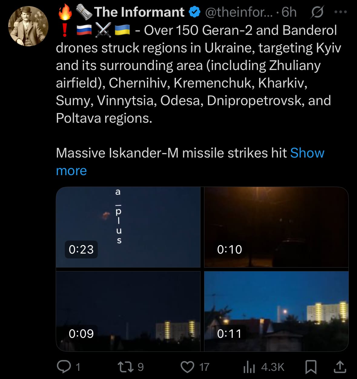
- Additionally, over a dozen Russian strategic aircraft deployed cruise missiles, accompanied by at least 60 more Geran-2 and Banderol drones, heading toward Ukrainian regions, indicating a sustained and large-scale offensive. On the same day, a counteroffensive saw over 100 Ukrainian drones and unmanned surface vehicles (USVs) targeting Russian territory, with significant activity reported at Bryansk Airport.
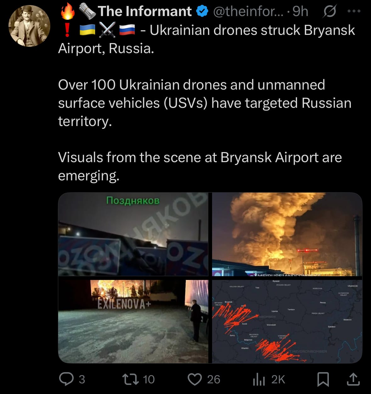
- The reciprocal attacks underscore the escalating use of drone and missile technology in the conflict, with both sides targeting key infrastructure. The strikes on Bryansk Airport, a strategic location, and the widespread Russian assaults on Ukrainian regions reflect the broadening scope of aerial warfare. These developments, documented through social media and visual reports, indicate a sharp rise in hostilities, impacting both military and civilian areas on either side of the border.
Environment & Weather:
- Yesterday, June 5, 2025, multiple tornadoes were confirmed in Lubbock County, West Texas, particularly near the areas of Morton and Lubbock, according to reports on X. The city of Lubbock itself was not directly struck, but nearby regions experienced notable impacts, including structural damage and fallen trees. The National Weather Service issued several Tornado Warnings for the area, with alerts remaining in effect into the early hours of June 6, 2025.
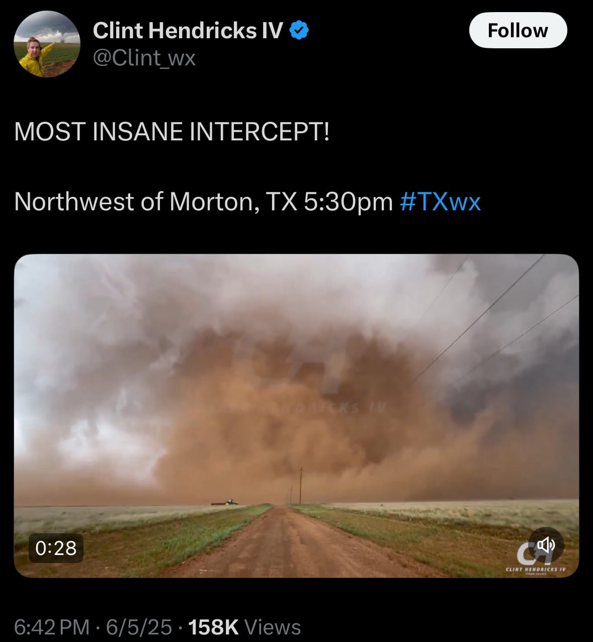
- The storms triggered tornado sirens across Lubbock County, prompting residents to seek shelter as a precaution. While Lubbock avoided a direct impact, the surrounding areas faced challenges due to the severe weather. The National Weather Service and local officials are likely evaluating the damage, and recovery efforts may be underway in affected communities.
Space:
- Yesterday, June 5, 2025, a Long March 6A rocket launched a batch of low Earth orbit (LEO) communication satellites, designated SatNet LEO Group 04, from the Taiyuan Satellite Launch Center in China. These satellites are part of the Guowang constellation, managed by the China Satellite Network Group (SatNet), a state-owned entity established in 2021.
- This mission, the fourth for the constellation, increases the total number of Guowang satellites in orbit to 29. The satellites were placed into a polar orbit to enable worldwide coverage, supporting the constellation’s objective of delivering broadband internet services. Similar to other large-scale constellations, it faces challenges such as orbital debris management and international regulatory coordination.
Statistic:
- Largest public Canadian companies by market capitalization:
- 🇨🇦 Royal Bank Of Canada: $179.15B
- 🇨🇦 Shopify: $134.03B
- 🇨🇦 Toronto Dominion Bank: $120.52B
- 🇨🇦 Enbridge: $102.17B
- 🇨🇦 Brookfield Asset Management: $91.26B
- 🇨🇦 Brookfield Corporation: $89.13B
- 🇨🇦 Thomson Reuters: $87.97B
- 🇨🇦 Bank of Montreal: $78.20B
- 🇨🇦 Constellation Software: $76.68B
- 🇨🇦 Canadian Pacific Railway: $76.16B
- 🇨🇦 Scotiabank: $66.80B
- 🇨🇦 Canadian National Railway: $66.40B
- 🇨🇦 Canadian Natural Resources: $64.87B
- 🇨🇦 CIBC: $64.18B
- 🇨🇦 Agnico Eagle Mines: $62.13B
- 🇨🇦 Manulife Financial: $54.89B
- 🇨🇦 TC Energy: $53.40B
- 🇨🇦 Alimentation Couche-Tard: $50.42B
- 🇨🇦 Loblaw Companies: $49.09B
- 🇨🇦 Suncor Energy: $44.92B
- 🇨🇦 Wheaton Precious Metals: $42.01B
- 🇨🇦 Intact Financial: $40.91B
- 🇨🇦 lululemon athletica: $40.27B
- 🇨🇦 National Bank of Canada: $38.07B
- 🇨🇦 Fairfax Financial: $37.58B
History:
- Tornado tracking technology has evolved significantly since the early 20th century, transitioning from rudimentary observations to sophisticated systems. Initially, tornado detection relied on visual sightings and basic weather instruments like barometers and thermometers, with reports often delayed or inconsistent. The establishment of the U.S. Weather Bureau in 1870 formalized weather monitoring, but it wasn’t until the 1940s and 1950s that radar technology emerged as a game-changer. Early weather radars, developed during World War II, allowed meteorologists to detect precipitation patterns associated with severe storms. By the 1950s, the first tornado warnings were issued based on radar data, though these systems lacked precision and often missed smaller or rapidly forming tornadoes. The introduction of Doppler radar in the 1980s marked a major leap, enabling scientists to measure wind speeds and directions within storms, thus identifying tornado signatures more accurately.
- The 1990s and 2000s brought further advancements with the widespread deployment of NEXRAD (Next-Generation Radar) systems across the United States, providing higher-resolution data and real-time monitoring. These radars, combined with improved computer models and satellite imagery, enhanced forecasters’ ability to predict tornado formation hours in advance. Mobile Doppler radars, such as those mounted on trucks, also emerged, allowing researchers to collect detailed data directly from tornadoes in the field. In recent years, technologies like dual-polarization radar have improved the detection of debris, helping confirm tornadoes on the ground. Additionally, the integration of artificial intelligence and machine learning has begun to refine prediction models, analyzing vast datasets to identify subtle patterns. Today, tornado tracking combines radar, satellite, ground observations, and advanced algorithms, significantly improving warning times and saving lives, though challenges remain in predicting exact tornado paths and intensities.
Image of the day:

Thanks for reading!
Earth is complicated, we make it simple.
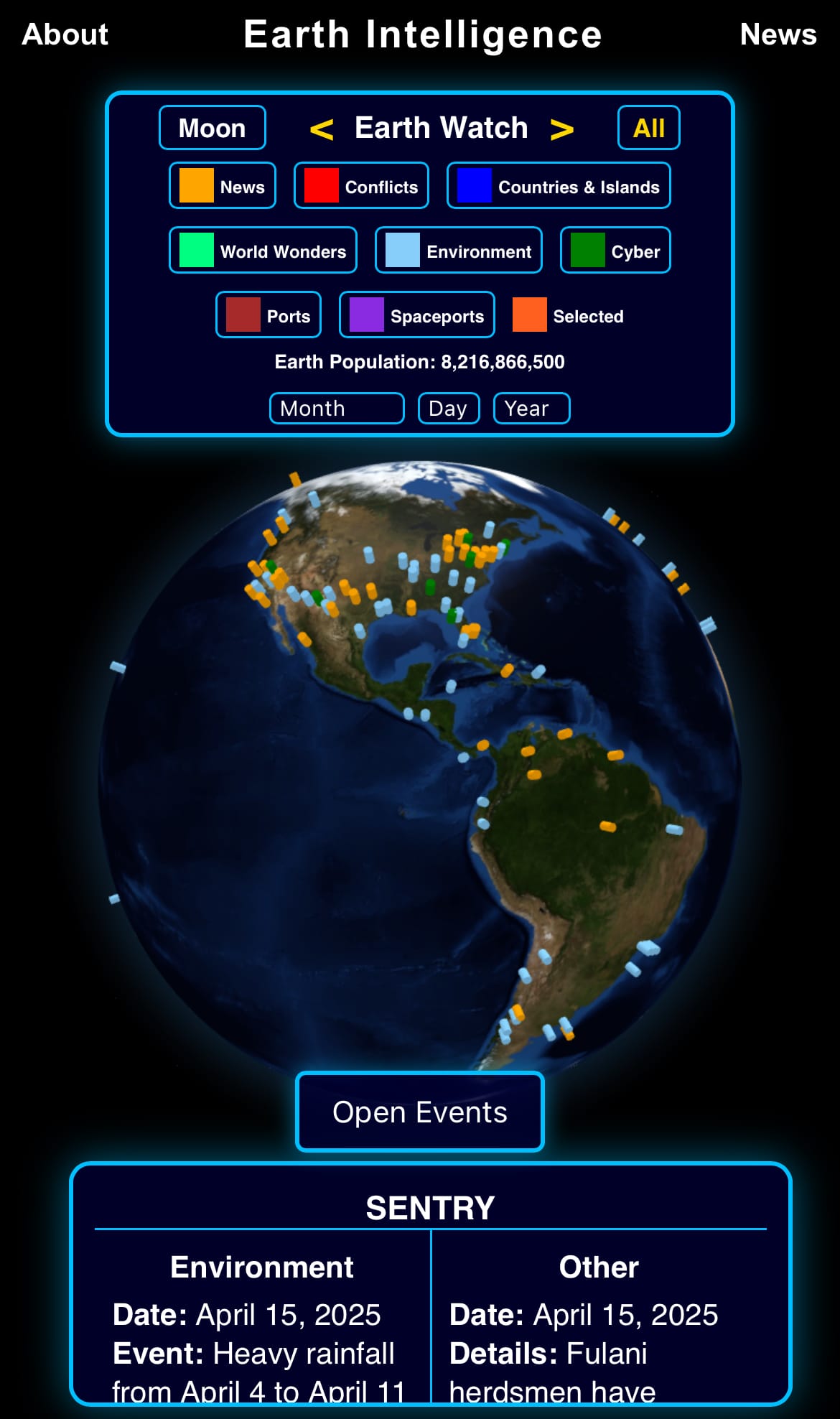
Click image to view the Earth Intelligence System:


Support/Suggestions Email:
earthintelligence@earthintel.news