Friday☕️


Economics & Markets:
- Yesterday’s U.S. stock market:

- Yesterday’s commodity market:

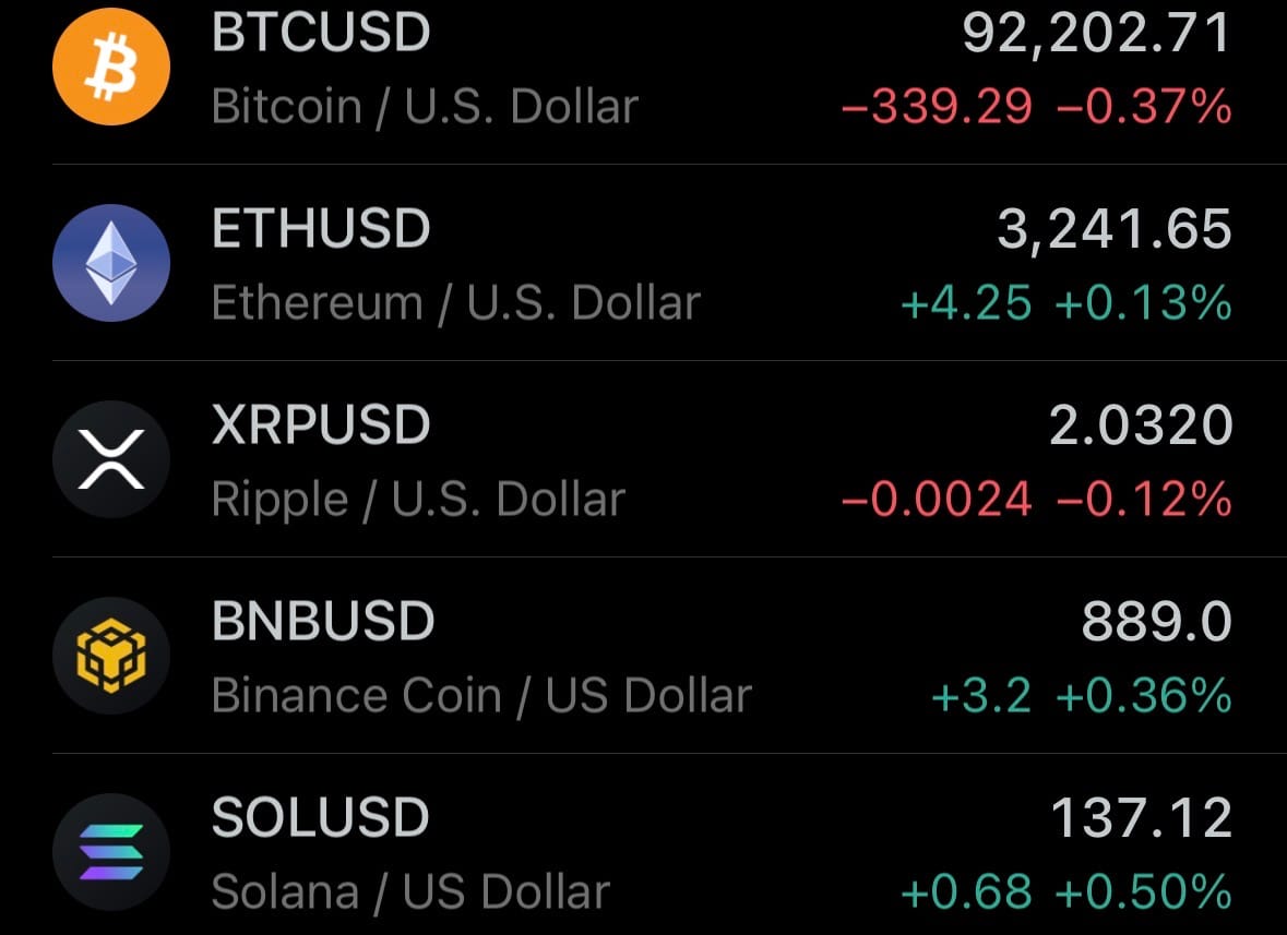
- Yesterday’s crypto market:
Environment & Weather:
- On December 11, 2025, Washington state officials warned that up to 100,000 residents could need to evacuate due to severe flooding from a prolonged atmospheric river storm that has brought heavy rain since early December. Rivers including the Skagit and Snohomish reached or approached record levels, with the Skagit River forecast to crest at up to 47 feet—exceeding 1990 highs—and raising risks of levee failures in towns like Concrete and Mount Vernon. Governor Bob Ferguson declared a statewide emergency on December 10, mobilizing the National Guard for flood response and requesting federal assistance. Level 3 ("go now") evacuation orders were issued for Skagit County's 100-year floodplain and parts of Pierce County.
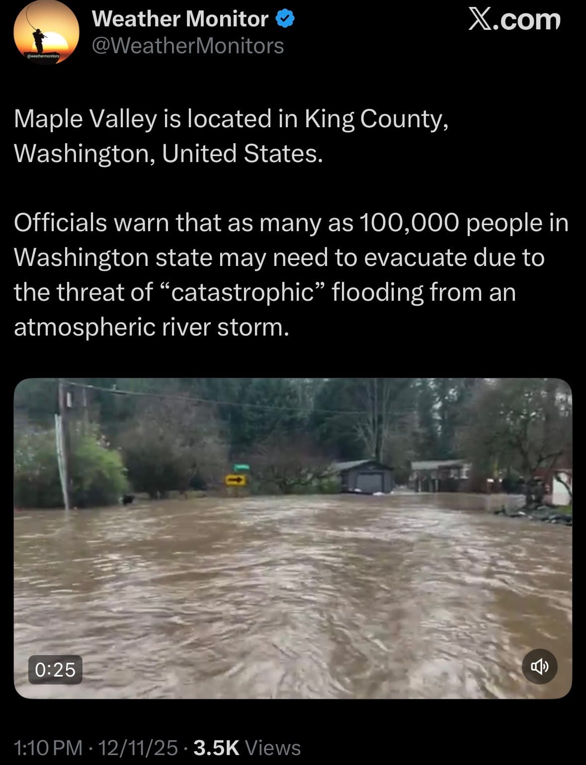
- In King County southeast of Seattle, the Cedar River overflowed, flooding low-lying areas and prompting evacuations in communities such as Maple Valley, where residents reported waist-deep water in homes. A 24/7 shelter opened at New Community Church in Maple Valley with cots, meals, and charging stations (pets not accommodated), and Maple Valley Highway was closed. Statewide, over 4,000 people sought shelter, thousands lost power, and major roads including Snoqualmie Pass were blocked. No deaths were reported, but injuries occurred during rescues, and initial property damage estimates exceeded $50 million. The storm (rated Category 4 for intensity) was expected to weaken by December 12, though more rain could follow mid-month, worsening conditions on saturated ground and wildfire burn scars.
Science & Technology:
- On December 11, 2025, OpenAI released GPT-5.2, an update to its GPT-5 series of AI models, aimed at improving performance for professional tasks such as coding, analyzing long documents, solving math problems, planning, and generating spreadsheets or presentations. The rollout follows an internal "code red" directive from CEO Sam Altman earlier in the month, which shifted resources in response to competition from models like Google's Gemini 3 and Anthropic's Claude Opus 4.5. GPT-5.2 comes in three variants: Instant for quick responses to simple queries like writing or translation; Thinking for structured work; and Pro for high-accuracy handling of complex issues. Paid ChatGPT subscribers on Plus, Pro, Go, Business, and Enterprise plans gained immediate access, with a gradual rollout for stability; free users will follow later, and developers can use the API right away.

- Early tests indicate GPT-5.2 matches or exceeds competitors on benchmarks including SWE-Bench Pro for coding, GPQA Diamond for scientific reasoning, and GDPval, where it completed 70.9% of professional tasks at or above expert level. It also halves error rates from GPT-5.1 on vision tasks like interpreting charts or software interfaces, handles up to 128,000 tokens of context, and supports tool integration for multi-step processes. Partners including Notion, Box, Shopify, Harvey, and Zoom reported strong results in real-world use. The model integrates today into Microsoft 365 Copilot for subscribers and GitHub Copilot for Pro/Business/Enterprise users; Altman said OpenAI plans to end "code red" operations by January 2026 to prioritize enterprise expansion.
Space:
- On December 11, 2025, SpaceX launched the Starlink Group 6-90 mission using a Falcon 9 rocket from Space Launch Complex 40 at Cape Canaveral Space Force Station in Florida. Liftoff took place at 5:01 p.m. EST (22:01 UTC). The rocket followed a southeasterly path over the Atlantic Ocean, and the first stage (booster B1083 on its 16th flight) separated and landed on the droneship Just Read the Instructions about eight minutes later. This was SpaceX's 161st Falcon 9 launch of 2025, the 118th for Starlink, and the 300th orbital launch worldwide that year.
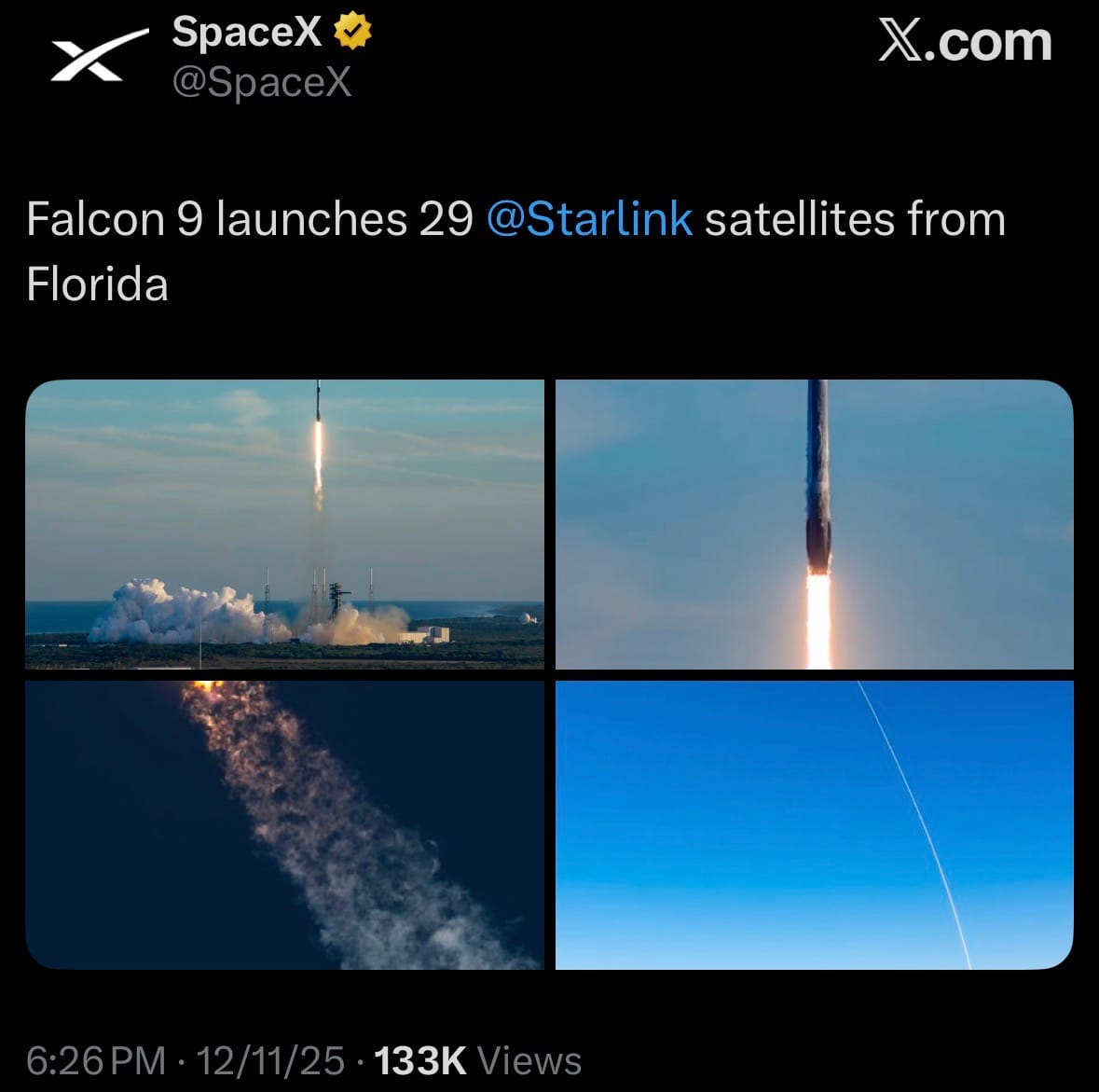
- The mission successfully deployed 29 V2 Mini Starlink satellites into low Earth orbit at around 530 km altitude. The satellites will move to their operational positions to help expand global broadband internet coverage, especially in equatorial and mid-latitude areas. Satellite deployment was confirmed about one hour after launch, with no issues reported and good weather conditions. The launch set a new SpaceX record for the fastest turnaround at SLC-40, coming just over two days after the previous mission from the same pad.
Chinese Launch:
- On December 11, 2025, China launched the SatNet LEO Group 16 mission using a Long March 12 rocket from the Wenchang Space Launch Site in Hainan province, marking the 79th orbital launch from the country in 2025. Liftoff occurred at 4:30 p.m. Beijing Time (08:30 UTC), with the two-stage, kerosene-liquid oxygen vehicle ascending on a southeasterly trajectory toward low Earth orbit. The mission proceeded nominally through stage separation and payload deployment, as confirmed by the China Aerospace Science and Technology Corporation, with no reported anomalies and favorable weather at the coastal facility.
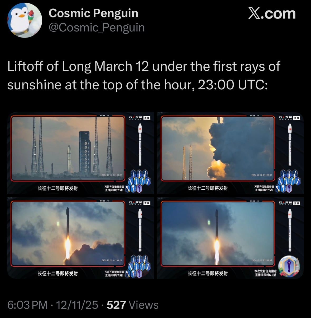
- SatNet LEO Group 16 deployed an undisclosed number of low Earth orbit communication satellites for the GuoWang (SatNet) megaconstellation, managed by the state-owned China Satellite Network Group Co., Ltd., to support global broadband internet services with both civilian and potential military applications. The constellation, planned for up to 12,992 satellites in two sub-networks (GW-A59 at ~500 km altitude and GW-2 at ~1,145 km), now has over 100 operational units following this batch, focusing on high-speed data relay, remote sensing, and secure communications.
Statistic:
- Largest public telecom companies on Earth by market capitalization:
- 🇨🇳 China Mobile: $242.50B
- 🇺🇸 T-Mobile US: $219.82B
- 🇺🇸 AT&T: $173.75B
- 🇺🇸 Verizon: $169.58B
- 🇩🇪 Deutsche Telekom: $157.39B
- 🇯🇵 SoftBank: $157.01B
- 🇮🇳 Bharti Airtel: $138.63B
- 🇺🇸 Comcast: $101.90B
- 🇨🇳 China Telecom: $87.05B
- 🇺🇸 American Tower: $85.08B
- 🇯🇵 NTT (Nippon Telegraph & Telephone): $81.65B
- 🇯🇵 KDDI: $65.72B
- 🇲🇽 America Movil: $64.45B
- 🇸🇬 Singtel: $58.77B
- 🇸🇦 Saudi Telecom Company: $57.63B
- 🇫🇷 Orange: $42.88B
- 🇦🇪 Emirates Telecom (Etisalat Group): $42.62B
- 🇺🇸 Crown Castle: $39.99B
- 🇦🇺 Telstra: $36.66B
- 🇨🇭 Swisscom: $35.78B
- 🇺🇸 Ciena: $34.17B
- 🇭🇰 China Unicom: $33.85B
- 🇹🇼 Chunghwa Telecom: $32.28B
- 🇺🇸 AST SpaceMobile: $31.13B
- 🇺🇸 EchoStar: $30.05B
History:
- Storm tracking starts as pattern-hunting in a chaotic sky. For most of history, the “model” was human memory: sailors reading cloud shapes and swell direction, farmers watching wind shifts, coastal communities naming storms by their scars. The first real leverage came from instruments that turned vibes into numbers. The barometer (1643) made air pressure measurable—suddenly a falling needle could warn of an approaching low-pressure system before the first violent gusts arrived. Over the 1700s–1800s, networks of observers began keeping standardized logs of pressure, temperature, wind, and rainfall, but the missing piece was speed: observations were isolated dots with no way to assemble a moving picture. That changed with the telegraph in the mid-1800s, which made “synoptic meteorology” possible—same-time observations gathered across wide areas so forecasters could see storms as traveling systems rather than local curses. This era produced the first modern warning services for ships and coasts, and by the late 1800s national weather bureaus were forming around the basic mission of storm warnings. The next conceptual leap arrived in 1904 when Vilhelm Bjerknes argued that weather prediction is fundamentally a physics problem: if you can measure the atmosphere’s starting state, you can forecast its future by integrating the governing equations forward in time. In the 1919–1921 period, the Bergen School sharpened practical forecasting with the “front” concept—warm and cold air masses colliding along boundaries that generate storms—giving meteorologists a way to diagnose storm structure and evolution on maps. Then technology took over: by the 1940s, radar—born from wartime electronics—began revealing storms in real time, turning invisible rain bands into trackable geometry. And in 1950, the first true numerical weather prediction ran on ENIAC: a 24-hour forecast that took about 24 hours of computing, crude but historic because it proved the atmosphere could be forecast by machines, not just by forecasters’ intuition.
- From the 1960s onward, storm prediction becomes a planetary sensing-and-compute system. The launch of TIROS-1 on April 1, 1960 gave humanity its first operational weather satellite view of clouds and cyclones from orbit—suddenly hurricanes could be tracked continuously over ocean, not rediscovered only when they hit land. In 1975, GOES-1 began the geostationary era of constant regional surveillance, feeding near-continuous imagery into forecast operations and drastically improving warning lead times for fast-developing systems. The 1970s–2000s then become a grind of refinement: better physics in numerical models, better data assimilation (methods that “blend” observations into model initial conditions), and a flood of new observations from satellites, aircraft, buoys, and radiosondes. Radar takes another major jump with operational Doppler networks—NEXRAD’s first operational WSR-88D install was June 12, 1992, with nationwide deployment largely completed by 1997—allowing forecasters to see rotation and wind structure inside severe storms and tornado-producing supercells, not just precipitation blobs. In the 2010s–2020s, hurricane track forecasts and severe weather warnings continued improving, but intensity—especially rapid intensification—remained notoriously hard because it depends on fine-scale ocean-atmosphere coupling and inner-core storm physics. That’s where today’s AI wave arrives: models like DeepMind’s GraphCast (research published 2023) showed machine learning can produce fast, skillful global forecasts out to 10 days, and ECMWF moved its AI Forecasting System (AIFS) into operations on February 25, 2025, running alongside traditional physics-based forecasting and reporting notable gains, including for tropical cyclone tracks. The practical future is a hybrid stack: physics-based models for grounded causality and extremes, AI for speed, pattern recognition, and massive ensembles, and satellites/radar providing the continuous “eyes” that keep models honest. Storm prediction is no longer just “where will it go?”—it’s probabilistic risk forecasting for power grids, shipping, aviation, flood control, wildfire weather, insurance, and emergency management, and it’s marching toward a world where global sensing plus AI can flag dangerous storms earlier, update faster, and quantify uncertainty in ways humans alone never could.
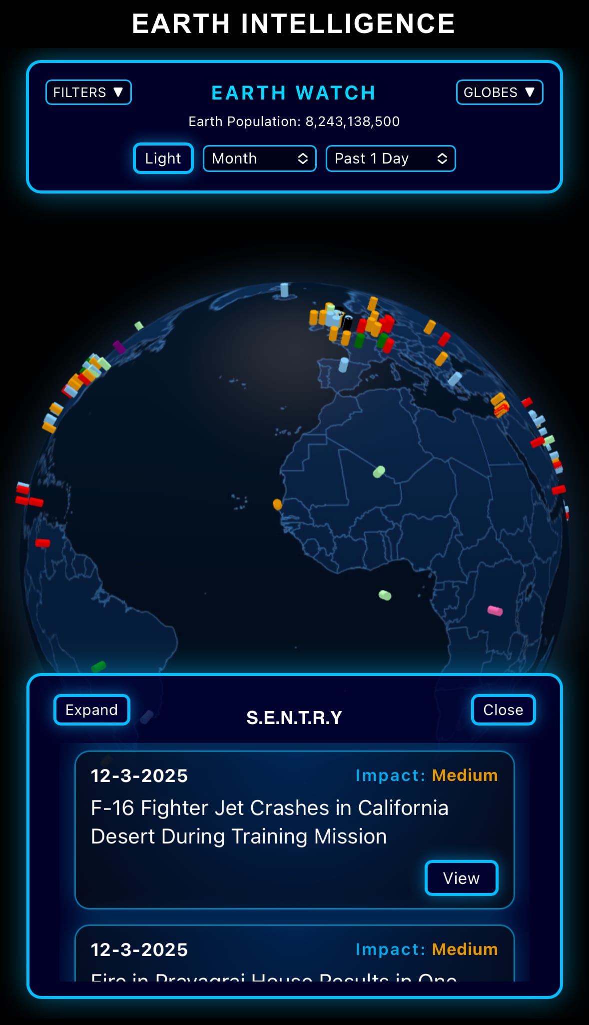
Image of the day:

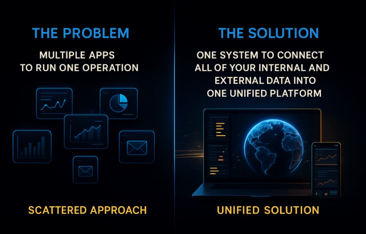
Thanks for reading! Earth is complicated, we make it simple.

- Click below if you’d like to view our free EARTH WATCH globe:
- Download our mobile app on the Apple App Store (Android coming soon):

Click below to view our previous newsletters:

Support/Suggestions Email:
earthintelligence@earthintel.news