Thursday☕️


Trending:
- As of March 11, 2026, the UN Security Council adopted Resolution 2817, a Bahrain-led resolution condemning Iran's missile and drone attacks on Bahrain, Kuwait, Oman, Qatar, Saudi Arabia, the UAE, and Jordan. The vote passed 13 in favor, 0 against, and 2 abstentions (China and Russia), and was co-sponsored by a record 135 countries.

- The resolution strongly denounces Iran's actions as violations of international law and threats to peace, demands Iran immediately stop all such attacks, and affirms the targeted countries' right to self-defense under the UN Charter. It does not mention or criticize the prior U.S. and Israeli strikes on Iran, leading Iran to call it a misuse of the Council, while a Russian alternative draft urging an end to the war without blame failed to pass.
Economics & Markets:
- As of March 11, 2026, the United States announced it will release 172 million barrels of crude oil from the Strategic Petroleum Reserve (SPR) to help lower surging energy prices amid the ongoing U.S.-Israel-Iran war. President Trump authorized the drawdown, which will begin next week and take approximately 120 days to deliver based on planned rates, as stated by Energy Secretary Chris Wright.

- The move is part of a coordinated International Energy Agency effort involving 32 member countries to release a total of 400 million barrels from global emergency reserves in response to supply disruptions and price spikes (with Brent crude exceeding $100–$110 per barrel). The U.S. plans to replenish the SPR with about 200 million barrels within the next year—more than the amount drawn down—at no additional taxpayer cost, though the reserve currently holds around 415 million barrels after the release.
- Yesterday’s U.S. stock market:

- Yesterday’s commodity market:

- Yesterday’s crypto market:

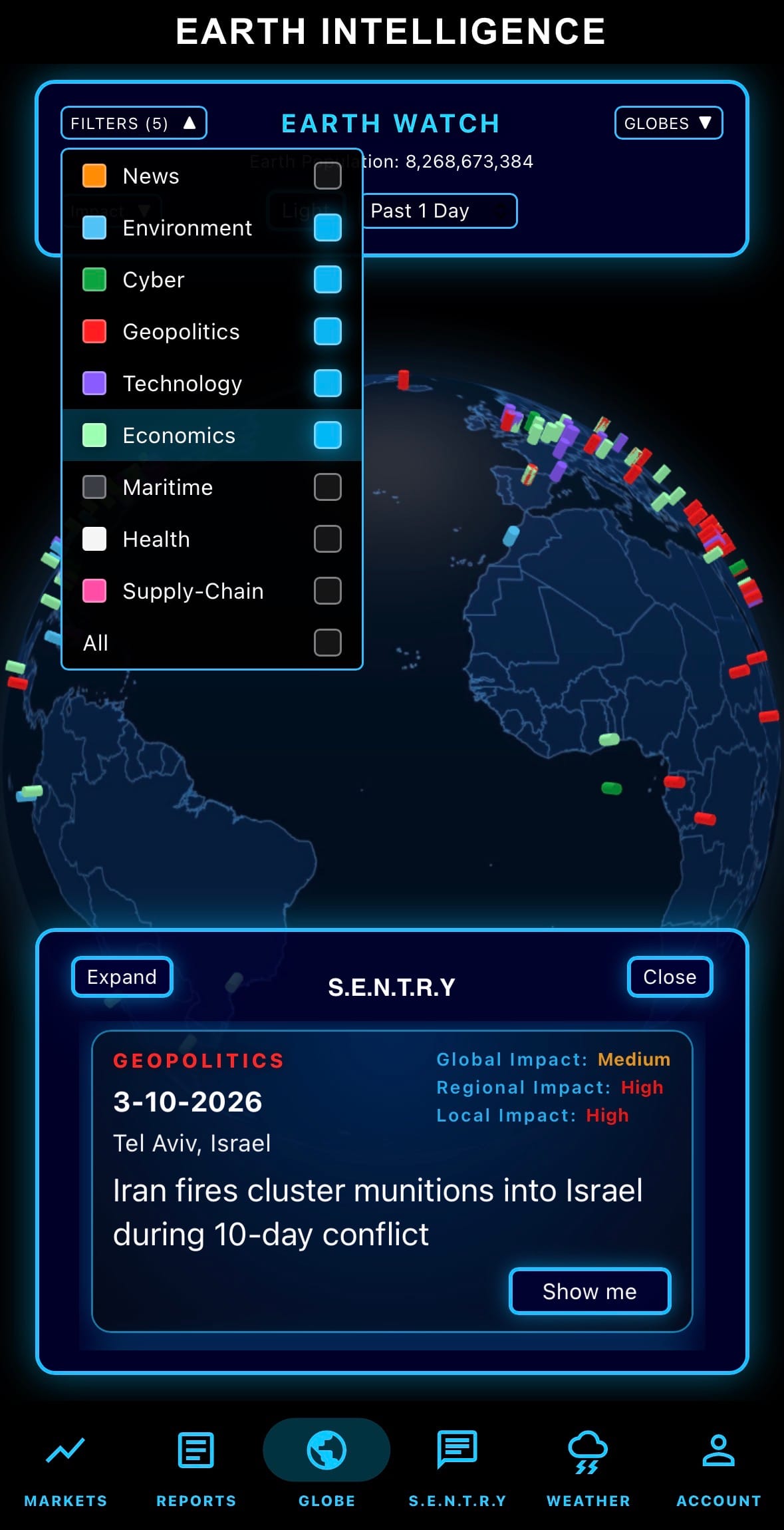
Geopolitics & Military Activity:
- On March 11, 2026 (late Wednesday), U.S. Central Command released unclassified footage showing airstrikes that destroyed a C-130 Hercules, a P-3 Orion, and an Ilyushin Il-76 transport aircraft at Ayatollah Hashemi Rafsanjani Airport in Kerman, Iran. These strikes are part of Operation Epic Fury, the U.S.-Israeli campaign launched on February 28, 2026, which has now hit over 5,000 targets—including missile facilities, airfields, command centers, and naval assets—to dismantle Iran's military capabilities and power projection.

- Iran confirmed damage to airport facilities and two out-of-service aircraft, while President Trump stated that Iran's air force has been "virtually destroyed" after 11–12 days of operations. The war has resulted in at least 1,940 deaths (mostly Iranian), displaced around 800,000 people, and caused seven U.S. fatalities with 140 injuries, with no immediate end to hostilities in sight.
Science & Technology:
- On March 11, 2026, Perplexity announced Personal Computer, an always-on extension of its Perplexity Computer AI agent system that runs 24/7 to handle tasks on your behalf. It operates via a dedicated, continuously running Mac mini (or similar Mac desktop) that merges local files, apps, and sessions with Perplexity's secure cloud servers for seamless, personal orchestration across devices from anywhere.

- The feature emphasizes privacy and security, giving users a persistent digital proxy that can access and act on local resources while leveraging Perplexity's multi-model AI capabilities. It's currently available via a waitlist for the initial cohort (primarily Perplexity Max subscribers at $200/month), with full support and resources provided to early participants.
Claude AI Announcement:
- As of March 11, 2026, Anthropic announced an update to Claude for Excel and Claude for PowerPoint that enables seamless synchronization between the two add-ins.

- When multiple files are open in both applications, Claude shares the full context of your ongoing conversation across them, allowing it to reference data, instructions, and prior steps without repetition. This means users can pull data from an Excel spreadsheet, build or analyze tables, generate charts, and directly update or insert elements into a PowerPoint deck in one continuous workflow—no manual copy-pasting or re-explaining required.
Statistic:
- Largest public semiconductor companies by market capitalization:
- 🇺🇸 NVIDIA: $4.521T
- 🇹🇼 TSMC: $1.838T
- 🇺🇸 Broadcom: $1.619T
- 🇰🇷 Samsung: $850.71B
- 🇳🇱 ASML: $544.49B
- 🇺🇸 Micron Technology: $471.23B
- 🇰🇷 SK Hynix: $443.23B
- 🇺🇸 AMD: $333.95B
- 🇺🇸 Applied Materials: $278.61B
- 🇺🇸 Lam Research: $274.90B
- 🇺🇸 Intel: $239.66B
- 🇺🇸 KLA: $192.48B
- 🇺🇸 Texas Instruments: $180.88B
- 🇺🇸 Analog Devices: $155.84B
- 🇺🇸 QUALCOMM: $143.24B
- 🇬🇧 Arm Holdings: $127.54B
- 🇯🇵 Tokyo Electron: $114.98B
- 🇯🇵 Advantest: $111.55B
- 🇹🇼 MediaTek: $89.35B
- 🇺🇸 Synopsys: $82.94B
- 🇨🇳 SMIC: $81.73B
- 🇺🇸 Marvell Technology: $78.99B
- 🇨🇳 Cambricon Technologies: $68.00B
- 🇩🇪 Infineon: $62.50B
- 🇺🇸 Monolithic Power Systems: $52.60B
History:
- The history of global navigation systems begins with humanity’s earliest attempts to determine position using the sky. For thousands of years, navigation relied on celestial navigation, where sailors used the Sun, Moon, and stars to determine direction and latitude. Ancient maritime civilizations such as the Phoenicians and Greeks (around 1000–500 BC) navigated using star patterns and the position of the North Star to guide voyages across the Mediterranean. While latitude could be estimated fairly reliably, determining longitude—the east–west position on Earth—remained one of navigation’s greatest unsolved problems. This changed in the 18th century when English clockmaker John Harrison developed the marine chronometer between 1730 and 1761, a highly accurate clock that allowed sailors to compare local solar time with the time at a reference meridian such as Greenwich. With precise timekeeping, navigators could finally calculate longitude accurately, dramatically improving ocean navigation and supporting the rapid expansion of global trade and exploration. In the 20th century, navigation moved from astronomy to electronics. During World War II, radio-based systems such as LORAN (Long Range Navigation) allowed ships and aircraft to determine their position by measuring signals from multiple radio transmitters across long distances.
- The space age transformed navigation completely. After the launch of Sputnik in 1957, scientists realized that satellite signals could be used for positioning on Earth. The United States first deployed the Transit satellite navigation system in 1964 for naval navigation, but the true breakthrough came with the development of the Global Positioning System (GPS), initiated by the U.S. Department of Defense in 1973 and reaching full operational capability in 1995. GPS satellites orbit Earth carrying highly precise atomic clocks and broadcast timing signals that allow receivers to calculate their location by measuring signal delays from multiple satellites. Other nations later built independent navigation systems to ensure strategic autonomy: Russia’s GLONASS, originally developed during the Cold War and modernized in the 2000s; the European Union’s Galileo system, launched beginning in 2011 as a civilian-controlled navigation network; and China’s BeiDou system, which expanded from regional coverage in the 2000s to full global service by 2020. Modern receivers often use signals from all of these constellations simultaneously, allowing positioning accuracy within meters—and even centimeters with advanced correction systems. Today satellite navigation underpins critical global infrastructure including aviation routes, maritime shipping, trucking logistics, financial network timing, telecommunications synchronization, and smartphone navigation. What began with sailors using stars and mechanical clocks has evolved into a global positioning architecture of dozens of satellites and atomic clocks orbiting Earth, forming one of the most essential invisible systems supporting modern civilization.
Image of the day:

Thanks for reading! Earth is complicated, we make it simple.
- Click below if you’d like to view our free EARTH WATCH globe:
- Download our mobile app:


Click below to view our previous newsletters:

Support/Suggestions Email:
support@earthintel.io