Tuesday☕️


Trending:
- Over the past 24 hours, Syria experienced a nationwide internet outage, with connectivity crashing to 1% of normal levels by March 25, 2025, according to NetBlocks. This digital blackout hit as unrest intensifies in cities like Latakia and Hama, where the HTS-led transitional government clashes with loyalists of the former regime. The cause remains unclear—possibilities include deliberate sabotage of telecom infrastructure, a known tactic in past conflicts, or unrelated issues like aging, strained infrastructure amid the chaos.
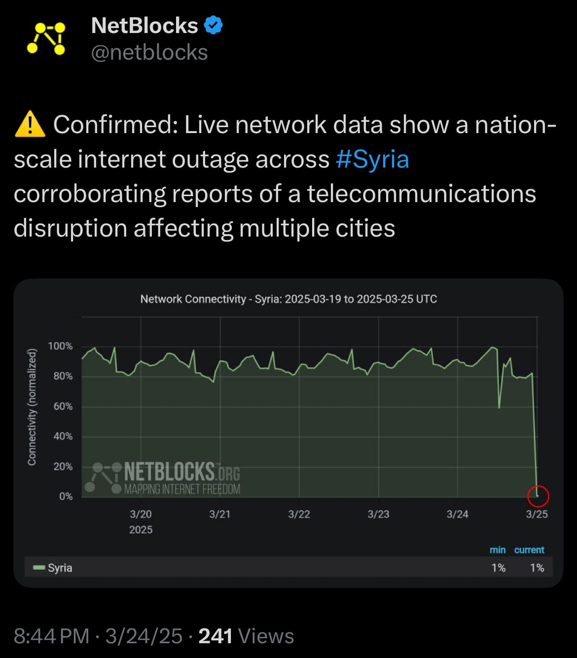
- Amid Syria’s tangled, multi-front war, involving the U.S. backing Kurdish-led forces against ISIS, Israel striking Iranian-linked targets, Turkey supporting rebels against the SDF, and HTS facing old-regime remnants, the outage adds another layer of complexity. Disrupting communication could provide a strategic advantage in this fractured conflict, hindering coordination among opposing groups. Yet, with no solid evidence, it remains difficult to pinpoint whether this was a calculated move, or collateral damage from the ongoing conflicts.
Economics & Markets:
- Yesterday’s U.S. stock market:

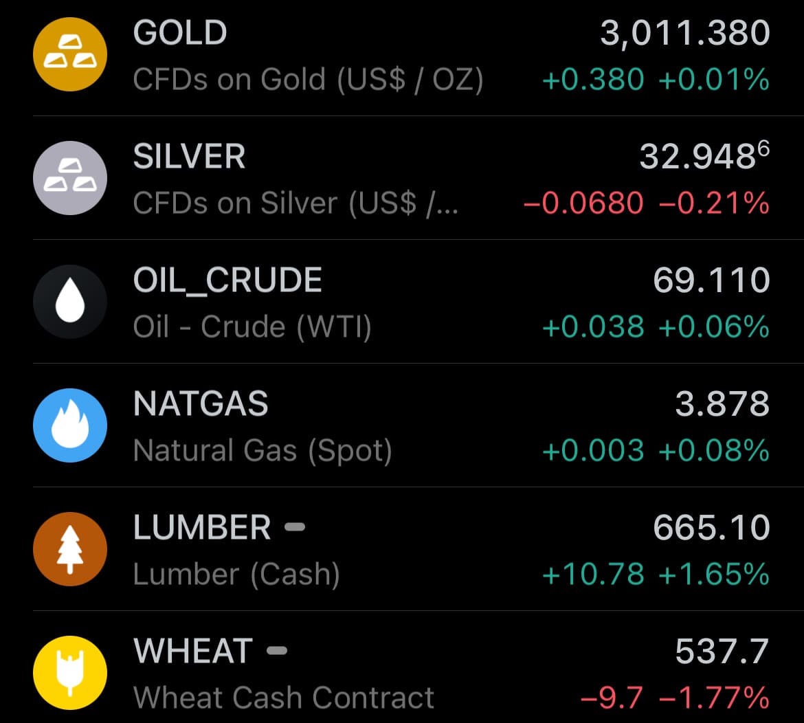
- Yesterday’s commodity market:
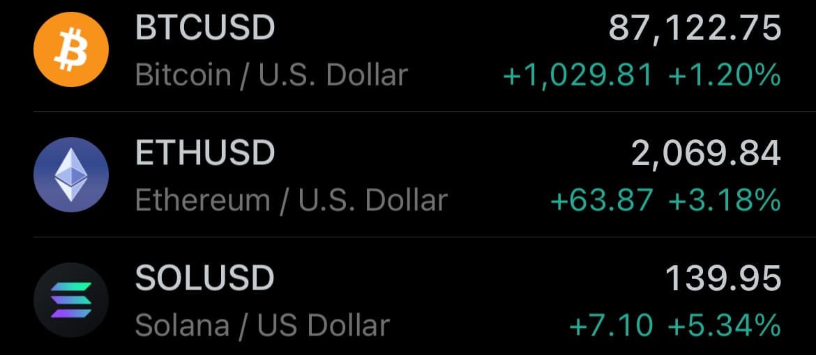
- Yesterday’s crypto market:
Geopolitics & Military Activity:

Environment & Weather:
- Yesterday, March 24, 2025, the National Weather Service’s Space Weather Prediction Center (NWSSWPC) issued a G2 (Moderate) geomagnetic storm watch for March 25, 2025, triggered by the anticipated arrival of a coronal hole high-speed stream (CH HSS). This solar event originates from a coronal hole—a region on the Sun where the magnetic field opens up, allowing solar wind to escape at higher speeds than usual. The SWPC forecasts that this stream will interact with Earth’s magnetic field, potentially causing moderate geomagnetic disturbances. The watch follows a pattern of expected solar activity, with G1 (Minor) storm conditions predicted for the 26th.
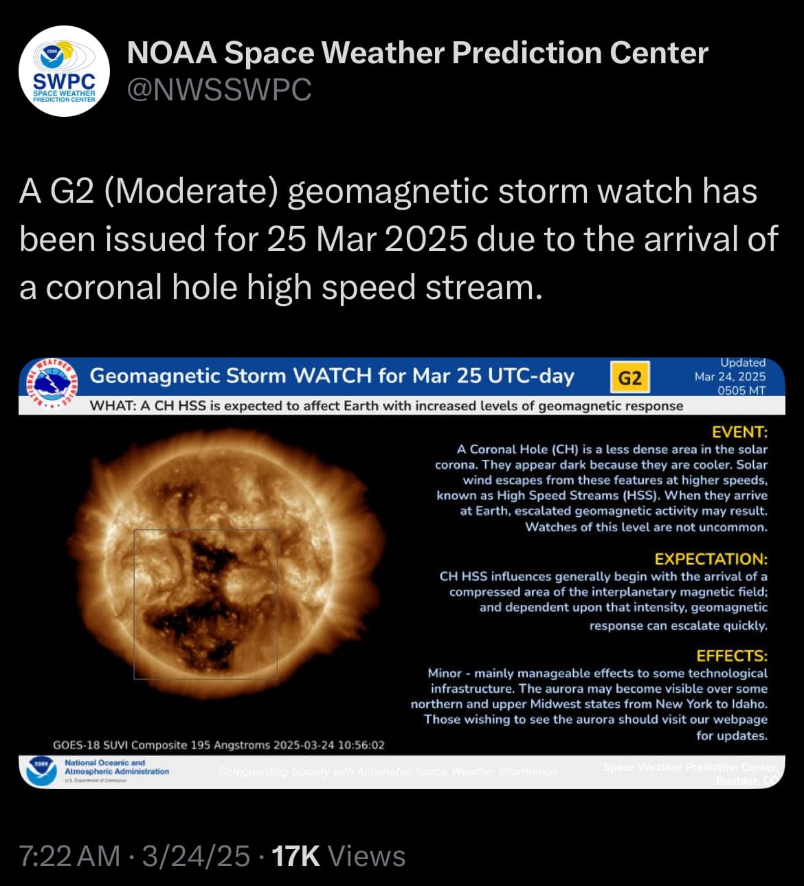
- A G2 geomagnetic storm can lead to noticeable effects, though it’s not extreme. Expect possible disruptions to high-frequency radio communications, particularly in polar regions, and slight impacts on satellite operations, which might require minor adjustments by operators. Power grids could experience weak voltage fluctuations, but widespread outages are unlikely. The high-speed stream’s interaction with Earth’s magnetosphere, known as a co-rotating interaction region, drives these effects, with solar wind speeds possibly exceeding 600 km/s, though exact outcomes depend on the stream’s strength and orientation when it arrives.
Space:
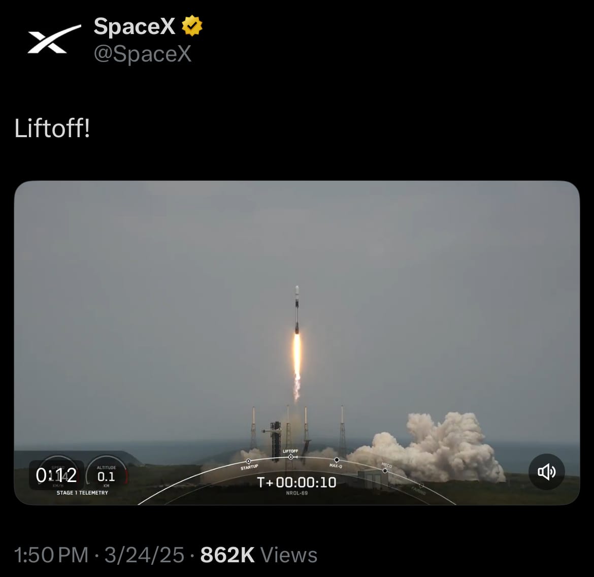
- Yesterday, March 24, 2025, SpaceX launched a Falcon 9 rocket from Space Launch Complex 40 at Cape Canaveral Space Force Station in Florida, carrying out the NROL-69 mission for the National Reconnaissance Office and the U.S. Space Force. The mission deployed a classified national security satellite, likely for intelligence or reconnaissance purposes, into orbit. After separation, the first-stage booster, B1092, landed back at Landing Zone 1, while the payload’s specifics stayed undisclosed, as is typical for NRO operations.
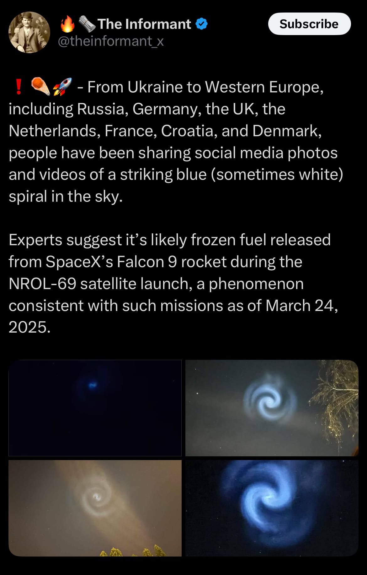
- Later that evening, a blue-and-white spiral lit up the sky, visible across Europe, the Middle East, and northern regions. One explanation suggests it was caused by the Falcon 9’s second stage venting fuel, like liquid oxygen or kerosene, which may have frozen into ice crystals and reflected sunlight, creating the pattern. Similar sightings have followed past SpaceX launches, such as Transporter-10 in 2024, but the exact reason isn’t confirmed. Other possibilities, including atmospheric effects, space events, or an unknown phenomenon.
Statistic:
- Largest public European Union companies by market capitalization:
- 🇩🇰 Novo Nordisk: $334.84B
- 🇫🇷 LVMH: $322.60B
- 🇩🇪 SAP: $322.12B
- 🇳🇱 ASML: $293.17B
- 🇫🇷 Hermès: $282.96B
- 🇫🇷 L’Oréal: $206.08B
- 🇳🇱 Prosus: $205.56B
- 🇮🇪 Accenture: $192.43B
- 🇩🇪 Siemens: $190.70B
- 🇩🇪 Deutsche Telekom: $176.32B
- 🇪🇸 Inditex: $158.17B
- 🇩🇪 Allianz SE: $146.74B
- 🇫🇷 Schneider Electric: $143.81B
- 🇳🇱 Airbus: $143.03B
- 🇫🇷 TotalEnergies: $141.66B
- 🇫🇷 Sanofi: $140.48B
- 🇫🇷 EssilorLuxottica: $133.49B
- 🇸🇪 Spotify: $123.78B
- 🇧🇪 Anheuser-Busch InBev: $121.35B
- 🇮🇪 Eaton: $118.64B
- 🇮🇪 Medtronic: $115.59B
- 🇫🇷 Safran: $113.65B
- 🇫🇷 Air Liquide: $110.66B
- 🇫🇷 Dior: $108.41B
- 🇪🇸 Santander: $106.25B
History:
- The conceptual foundations of LiDAR (Light Detection and Ranging) technology can be traced back to early 20th-century experiments with light-based distance measurement, but it wasn’t until the invention of the laser in 1960 that true LiDAR systems became possible. Early developments in the 1960s were driven by military and atmospheric research, with NASA among the first to use laser range-finding techniques for measuring distances to satellites and the Moon. By the 1970s, LiDAR systems were being mounted on aircraft for topographic mapping, providing a new way to measure the Earth’s surface with unprecedented precision. This shift marked the beginning of LiDAR’s evolution from an experimental tool into a valuable technology for earth sciences and mapping.
- As laser technology and computing power improved through the 1980s and 1990s, LiDAR became more accessible and its applications expanded rapidly. Airborne LiDAR was used for creating highly detailed digital elevation models, transforming industries such as forestry, geology, and later, urban planning. By the early 2000s, LiDAR systems had been miniaturized enough for use in smaller aircraft, drones, and ground-based platforms, enabling detailed mapping of archaeological sites, infrastructure, and even autonomous vehicle navigation. Compared to radar, which uses radio waves for long-range detection, LiDAR’s use of laser light provided much finer resolution, making it ideal for precision measurement and 3D modeling. Today, LiDAR continues to evolve, integrating with AI and machine learning for real-time environmental analysis across sectors ranging from climate science to robotics.
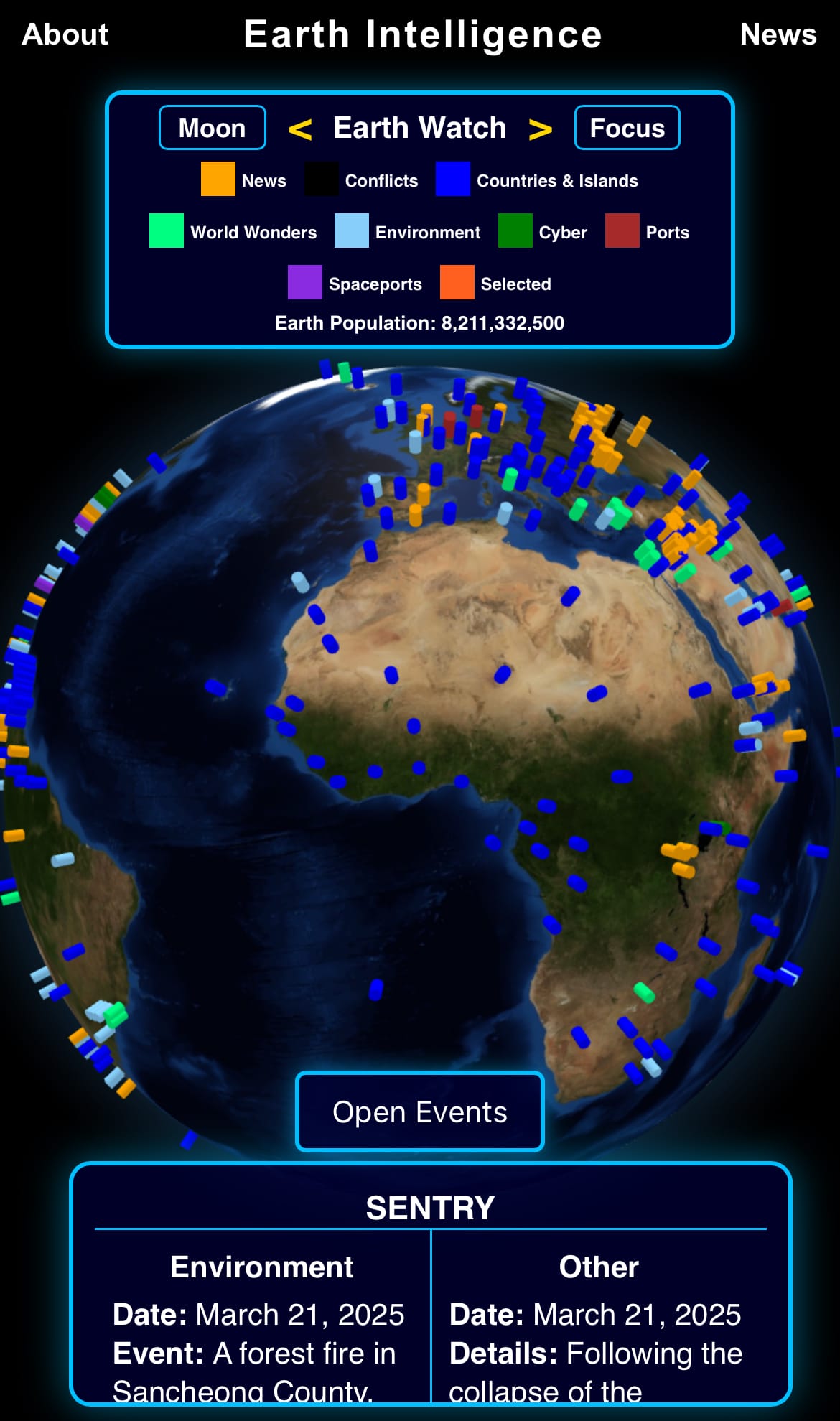
Image of the day:

Thanks for reading!
Earth is complicated, we make it simple.
Click image to view the Earth Intelligence System:


Support/Suggestions Email:
earthintelligence@earthintel.news