Tuesday☕️


Economics & Markets:
- Yesterday’s U.S. stock market:

- Today’s commodity market:

- Today’s crypto market:

Environment & Weather:
- Yesterday, May 19, 2025, severe flooding impacted Tonneins, a commune in southwestern France, located in the Lot-et-Garonne department along the Garonne River. The flooding was significant, with water levels submerging streets and reaching the hoods of vehicles, disrupting local transportation and likely affecting residents and businesses. Tonneins’ proximity to the Garonne River makes it vulnerable to such events, as heavy rainfall can cause the river to overflow, inundating the surrounding areas and highlighting the challenges of managing extreme weather in low-lying regions.

- The flooding in Tonneins was part of a larger weather event in southwestern France, which also included a severe hailstorm in nearby areas. That evening, intense storms brought heavy rain and large hailstones—some as big as golf balls—to parts of the Lot-et-Garonne and neighboring departments, according to regional weather reports. The hail caused additional damage, breaking windows, denting vehicles, and harming crops and buildings. This combination of flooding and hail reflects a broader trend of increasing extreme weather in France, driven by climate change, which has led to more intense rainfall and storm activity in recent years.
Space:
- Yesterday, May 19, 2025, Starlink, a satellite internet service operated by SpaceX, announced the launch of its high-speed, low-latency internet in Bangladesh, as shared in a post on X by the official Starlink account. The accompanying map highlights Bangladesh in blue, signifying that the service is now available nationwide. With a population of around 175.7 million, Bangladesh is the eighth-most populous country globally, making this rollout significant for addressing connectivity challenges across urban centers like Dhaka and remote regions in a nation bordered by India, Myanmar, and the Bay of Bengal.
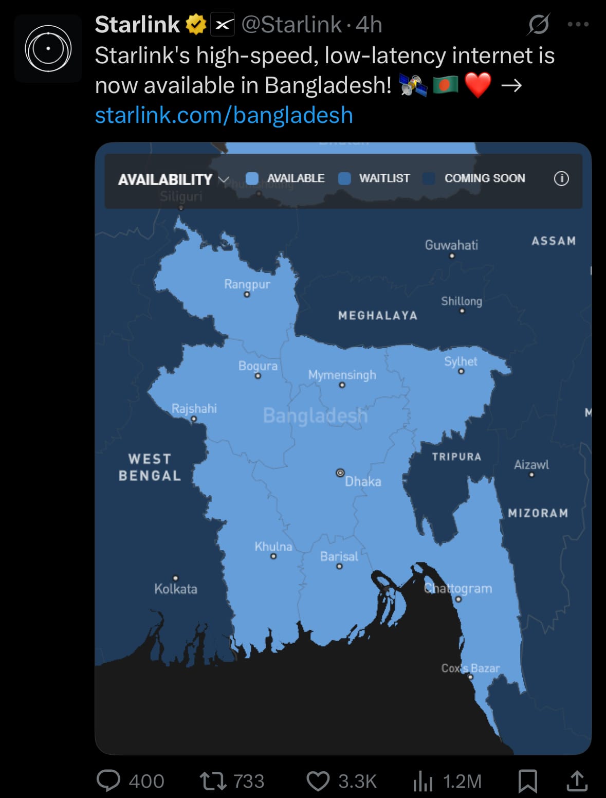
- Starlink’s network, comprising over 7,500 satellites in low Earth orbit, is designed to offer global coverage, capable of supporting internet access across the entire planet. However, the availability of the service in any given country depends on regulatory approval from local governments, which must grant permission for Starlink to operate within their borders. In Bangladesh’s case, this approval has enabled the service to go live, potentially enhancing digital infrastructure for education, commerce, and communication for its 175.7 million residents.
Science & Technology:
- Yesterday, May 19, 2025, OpenAI announced the integration of Codex, its AI-powered coding assistant, into the ChatGPT iOS app, as shared in a post on X by the OpenAI Developers account. This update enables users to perform coding tasks directly from their iPhones, including starting new tasks, viewing code differences, requesting changes, and pushing pull requests (PRs) on the go. The announcement, showcases features like exploring files, adding push PR buttons, and archiving tasks, allowing developers to manage coding activities from their mobile devices while syncing live updates when they return to their computers.
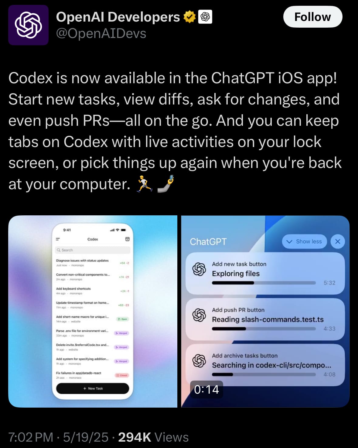
- Codex, the AI model behind this integration, is designed to understand and generate code in multiple programming languages, such as Python, JavaScript, and Java, making it a versatile tool for developers. It can interpret natural language prompts to write code, debug existing scripts, suggest improvements, and even complete code snippets based on context. By embedding Codex into the ChatGPT iOS app, OpenAI enables developers to leverage these capabilities on the go, whether they’re drafting new functions, reviewing code changes, or automating repetitive tasks. This mobile access to Codex’s functionality could enhance productivity for developers who need to code or manage projects outside traditional desktop environments, offering a seamless bridge between mobile and computer-based workflows.
Statistic:
- Largest assets on Earth by market capitalization:
- Gold: $21.585T
- 🇺🇸 Microsoft: $3.410T
- 🇺🇸 NVIDIA: $3.306T
- 🇺🇸 Apple: $3.118T
- 🇺🇸 Amazon: $2.188T
- Bitcoin: $2.099T
- 🇺🇸 Alphabet (Google): $2.028T
- Silver: $1.816T
- 🇸🇦 Saudi Aramco: $1.692T
- 🇺🇸 Meta Platforms: $1.610T
- 🇺🇸 Berkshire Hathaway: $1.104T
- 🇺🇸 Tesla: $1.101T
- 🇺🇸 Broadcom: $1.084T
- 🇹🇼 TSMC: $1.003T
- 🇺🇸 Walmart: $785.04B
- 🇺🇸 JPMorgan Chase: $736.12B
- 🇺🇸 Visa: $704.77B
- 🇺🇸 Eli Lilly: $677.88B
- 🇨🇳 Tencent: $600.92B
- SPDR S&P 500 ETF Trust: $545.94B
- 🇺🇸 Mastercard: $532.50B
- 🇺🇸 Netflix: $507.12B
- 🇺🇸 Costco: $458.91B
- 🇺🇸 Exxon Mobil: $458.84B
- 🇺🇸 Oracle: $447.66B
History:
- Floods have shaped human history for millennia, with ancient civilizations like those along the Nile and Indus Rivers developing early flood management systems to harness seasonal inundations for agriculture while mitigating destruction. Major historical floods, such as the 1887 Yellow River flood in China, which killed hundreds of thousands, underscored the need for systematic flood tracking and prediction. Early methods relied on manual observations, like river gauges and weather records, often maintained by local communities or rudimentary government agencies. By the 20th century, advancements in meteorology and hydrology led to more structured approaches, including the use of rain gauges, streamflow measurements, and basic statistical models to predict flood risks. However, these methods were often reactive, limited by sparse data and localized scope, leaving many regions vulnerable to catastrophic flooding.
- Modern flood tracking and prediction have transformed with technology, integrating satellite imagery, radar, and computational models for real-time monitoring and forecasting. Systems like the U.S. National Weather Service’s Advanced Hydrologic Prediction Service use data from ground sensors, weather radar, and global satellite networks to model river flows and predict flood probabilities with high accuracy. Machine learning and AI now enhance predictive capabilities, analyzing vast datasets to identify patterns and improve early warning systems. Technologies like LiDAR and drone-based mapping provide detailed topographic data for flood risk assessments, while global initiatives, such as the World Meteorological Organization’s flood forecasting programs, standardize data sharing across borders. Despite these advances, challenges remain, particularly in developing nations where infrastructure and data gaps hinder effective flood management, highlighting the need for equitable access to forecasting technologies.
Image of the day:

Thanks for reading!
Earth is complicated, we make it simple.
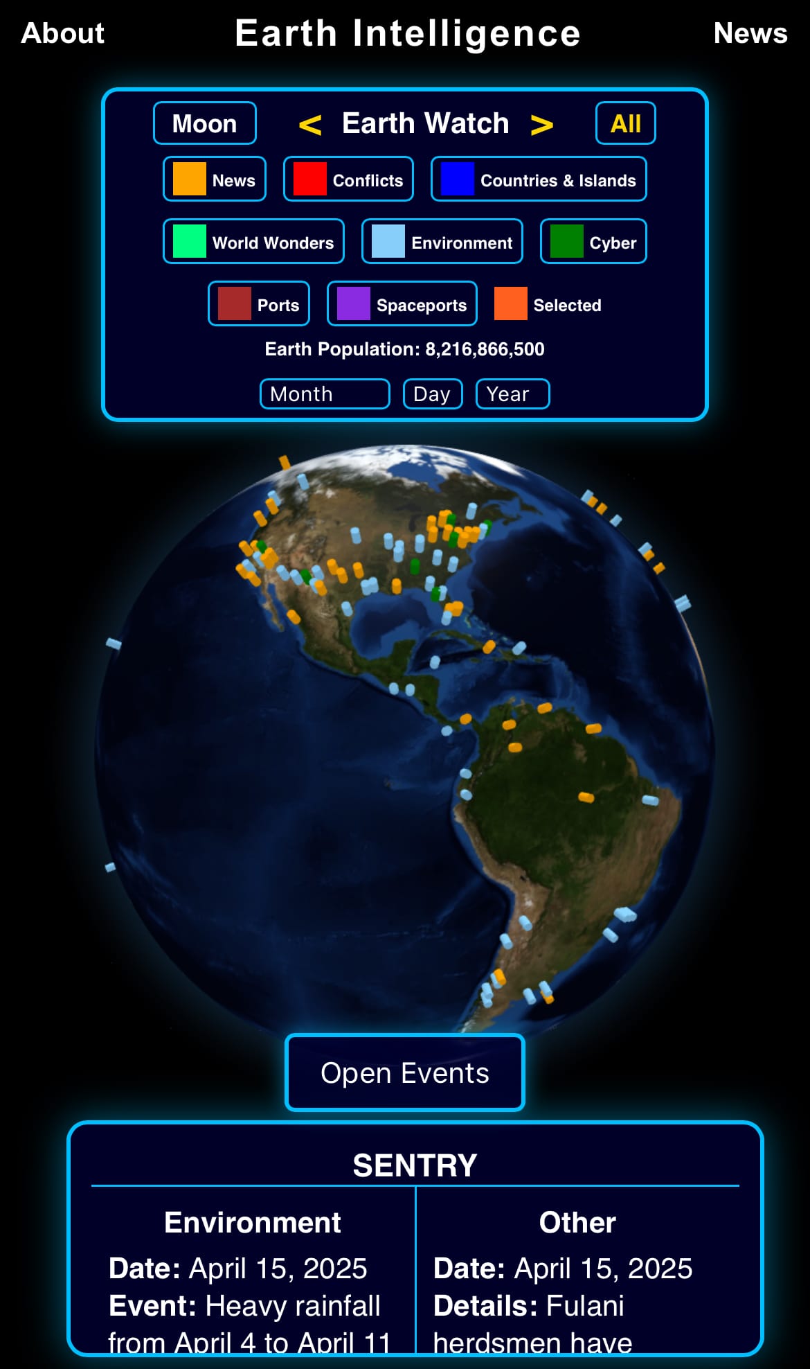
Click image to view the Earth Intelligence System:


Support/Suggestions Email:
earthintelligence@earthintel.news