Tuesday☕️


Economics & Markets:

- On April 13, 2026, Strategy (formerly MicroStrategy, $MSTR) announced it acquired another 13,927 BTC for ~$1.00 billion at an average price of ~$71,902 per bitcoin, bringing its total holdings to 780,897 BTC as of April 12. These were purchased for a cumulative ~$59.02 billion at an average cost of ~$75,577 per bitcoin, and the company has delivered a 5.6% BTC Yield year-to-date in 2026.
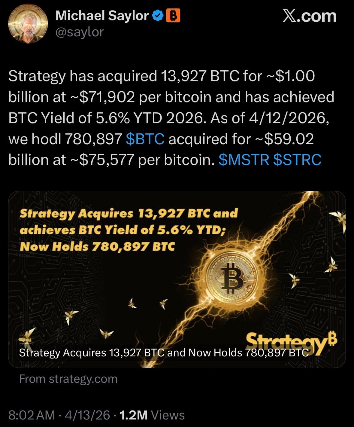
- Strategy remains by far the largest corporate Bitcoin holder in the world, controlling roughly 3.7–3.8% of all BTC in circulation — dwarfing the next largest public company (Twenty One Capital with ~43,500 BTC) and even most other major entities like MARA (~38,700 BTC) or Metaplanet (~40,000 BTC).
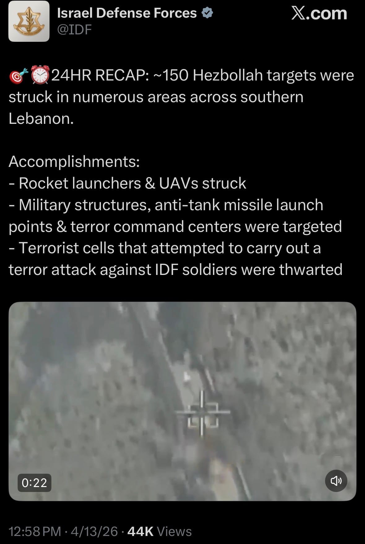
Geopolitics & Military Activity:
- On April 13, 2026, the U.S. Secretary of War and the Indonesian Minister of Defense announced the establishment of the U.S.-Indonesia Major Defense Cooperation Partnership (MDCP), a new high-level bilateral defense framework designed to strengthen military ties and promote stability in the Indo-Pacific.
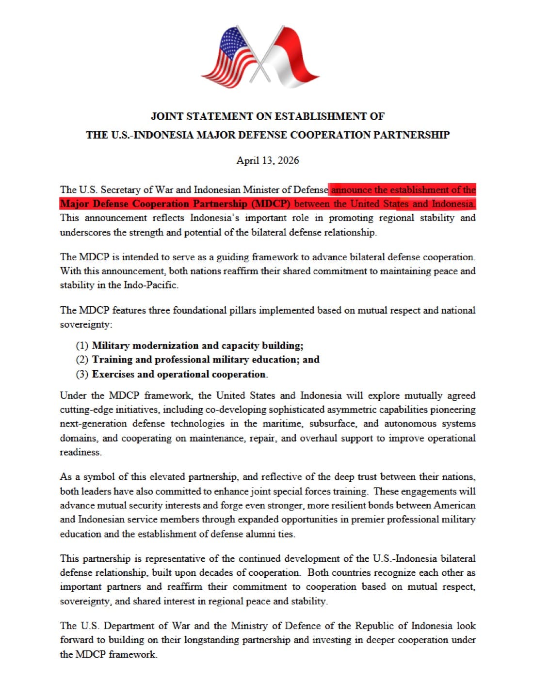
- The MDCP is built on three foundational pillars—military modernization and capacity building, training and professional military education, and exercises and operational cooperation—while emphasizing mutual respect and national sovereignty. It will enable deeper collaboration on cutting-edge initiatives, including co-development of asymmetric capabilities in maritime, sub-surface, and autonomous systems, as well as enhanced joint special forces training.
Environment & Weather:
- As of Tuesday, April 14, 2026, at 7:58 AM ChST, Super Typhoon Sinlaku (04W) is a powerful Category 5 storm with maximum sustained winds near 180 mph, tracking northwest toward the Northern Mariana Islands.
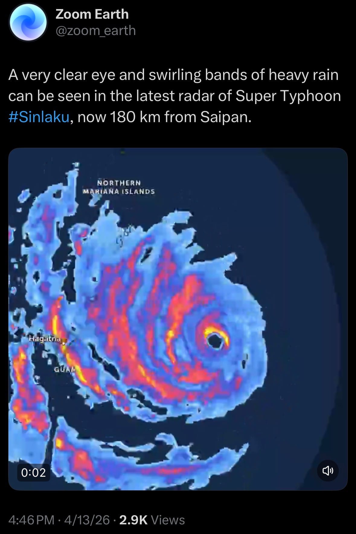
- Typhoon warnings are in effect for Rota, Tinian, Saipan, Alamagan, Pagan, and Agrihan, while Guam remains under a tropical storm warning and typhoon watch. The storm is expected to bring life-threatening winds, destructive storm surge, and torrential rainfall as it passes very close to or directly over Tinian and Saipan later today.
Science & Technology:
- US smartphone imports from China have collapsed from around 90% dominance in recent years to just 25% in Q2 2025, with India surging to 44% and Vietnam at 30% as Apple and other manufacturers accelerate final assembly shifts to avoid tariffs and geopolitical risks.
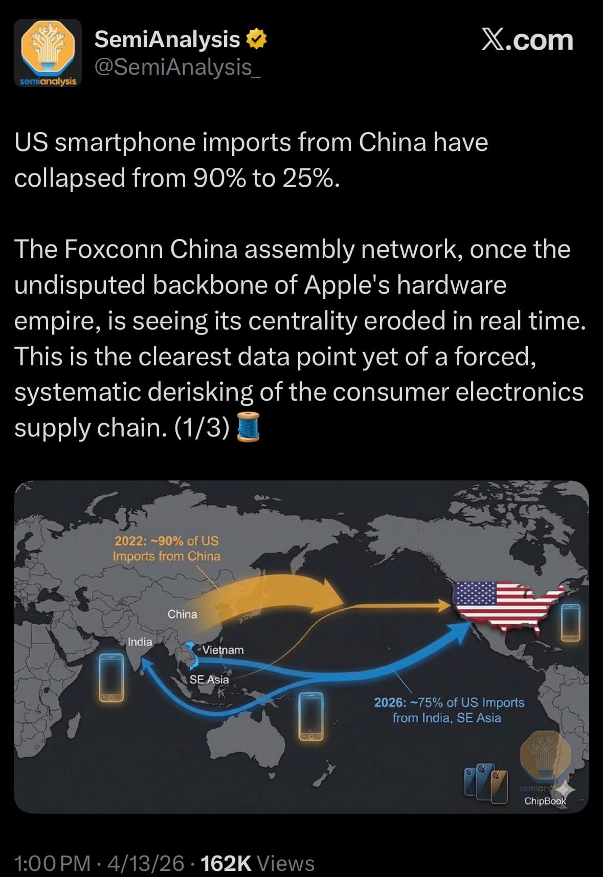
- Foxconn’s massive China-based network, once the core of Apple’s production, is rapidly losing centrality for US-bound iPhones, but China remains deeply involved by supplying the vast majority of high-value components, sub-assemblies, and materials (often 70-90% of an iPhone’s value) that are then shipped to India and Vietnam for final assembly. This reflects a forced but incomplete derisking of the consumer electronics supply chain, where final “Made in India” labeling masks continued heavy reliance on Chinese upstream manufacturing.
Space:
- On April 13, 2026, MDA Space unveiled MDA MIDNIGHT™, a highly maneuverable spacecraft platform designed for defense organizations to defend and protect the space domain using high-reliability rendezvous and proximity operations (RPO), advanced robotics, and space domain awareness capabilities.
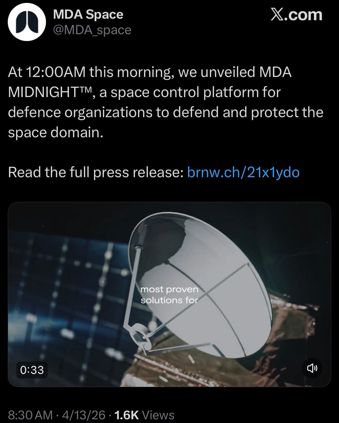
- It can detect, identify, track, counter, and deter threats to critical satellites and orbits in low Earth orbit, with its initial mission focused on rendezvousing with space assets to perform on-orbit inspection, electronic countermeasure detection, cooperative satellite capture and release, asset relocation, refueling support, and de-orbiting of non-operational objects.
Statistic:
- Largest tech companies on Earth by market capitalization:
- 🇺🇸 NVIDIA: $4.601T
- 🇺🇸 Alphabet (Google): $3.861T
- 🇺🇸 Apple: $3.809T
- 🇺🇸 Microsoft: $2.856T
- 🇺🇸 Amazon: $2.579T
- 🇹🇼 TSMC: $1.916T
- 🇺🇸 Broadcom: $1.800T
- 🇺🇸 Meta Platforms: $1.605T
- 🇺🇸 Tesla: $1.322T
- 🇰🇷 Samsung: $897.33B
- 🇳🇱 ASML: $589.06B
- 🇨🇳 Tencent: $575.26B
- 🇰🇷 SK Hynix: $498.39B
- 🇺🇸 Micron Technology: $481.04B
- 🇺🇸 Oracle: $447.57B
- 🇺🇸 Netflix: $437.59B
- 🇺🇸 AMD: $402.43B
- 🇺🇸 Lam Research: $335.76B
- 🇺🇸 Intel: $327.26B
- 🇺🇸 Cisco: $325.37B
- 🇺🇸 Palantir: $316.58B
- 🇺🇸 Applied Materials: $314.05B
- 🇨🇳 Alibaba: $306.16B
- 🇺🇸 KLA: $232.40B
- 🇺🇸 IBM: $223.17B
History:
- Storm tracking began as simple observation long before modern technology, relying on human interpretation of weather patterns, clouds, and seasonal changes. Ancient civilizations like the Greeks and Chinese documented storms, but real progress began in the 17th–19th centuries with the invention of scientific instruments like the barometer (1643, Evangelista Torricelli), which allowed detection of pressure drops associated with storms, and the anemometer, which measured wind speed. In the early 1800s, meteorologists like Luke Howard began classifying clouds, giving structure to storm identification, while Robert FitzRoy in the 1850s—who later led early weather services in Britain—used telegraph networks to collect real-time weather data across regions, enabling the first basic storm warnings. The telegraph was a major breakthrough because it allowed weather data to move faster than the storm itself. By the late 1800s and early 1900s, national weather services formed, and meteorologists began mapping storms using pressure charts and isobars, identifying cyclonic systems and tracking their movement across continents and oceans, though still with limited accuracy.
- The biggest leap came in the 20th century with the introduction of advanced sensing technologies. During World War II, radar—originally developed to detect aircraft—was discovered to also detect precipitation, allowing scientists to visualize storm structure in real time. By the 1950s–60s, radar networks became central to storm tracking, enabling detection of rain bands, storm intensity, and movement. The launch of the first weather satellite, TIROS-1 in 1960, revolutionized global storm tracking by providing images of cloud systems from space, making it possible to monitor hurricanes and cyclones over oceans where no ground data existed. This was followed by geostationary satellites (GOES, starting in 1975), which could continuously observe the same region, providing constant updates on storm development. In the 1970s–1990s, computer modeling and numerical weather prediction (NWP) advanced rapidly, allowing meteorologists to simulate storm paths using atmospheric data, while tools like Doppler radar (introduced widely in the 1980s–90s) added the ability to measure wind velocity inside storms, critical for detecting tornado rotation. Aircraft reconnaissance (“Hurricane Hunters”), ocean buoys, and dropsondes further improved real-time data collection directly inside storms.
- From the 2000s to 2026, storm tracking has evolved into a highly integrated, data-driven system combining satellites, sensors, and AI. Modern satellites use infrared, microwave, and hyperspectral imaging to measure temperature, moisture, and storm structure in extreme detail, even through cloud cover. Systems like GOES-R series (launched starting 2016) provide high-resolution imagery every 30–60 seconds, allowing near real-time monitoring of storm intensification. Scatterometers measure ocean surface winds, while LiDAR and advanced radar systems improve vertical profiling of storms. Massive global data networks feed into supercomputers running advanced models like the GFS (Global Forecast System) and ECMWF, which can predict storm paths days in advance with increasing accuracy. AI and machine learning are now being layered on top to improve rapid intensification forecasting—a historically difficult problem. Today, storm tracking is not just about watching storms, but predicting behavior, impact, and risk in real time, supporting everything from disaster response to insurance and infrastructure planning. What began as simple observation has become a global sensing system, turning the atmosphere into a continuously monitored environment where storms can be tracked, analyzed, and increasingly anticipated with precision.
Image of the day:

Thanks for reading! Earth is complicated, we make it simple.
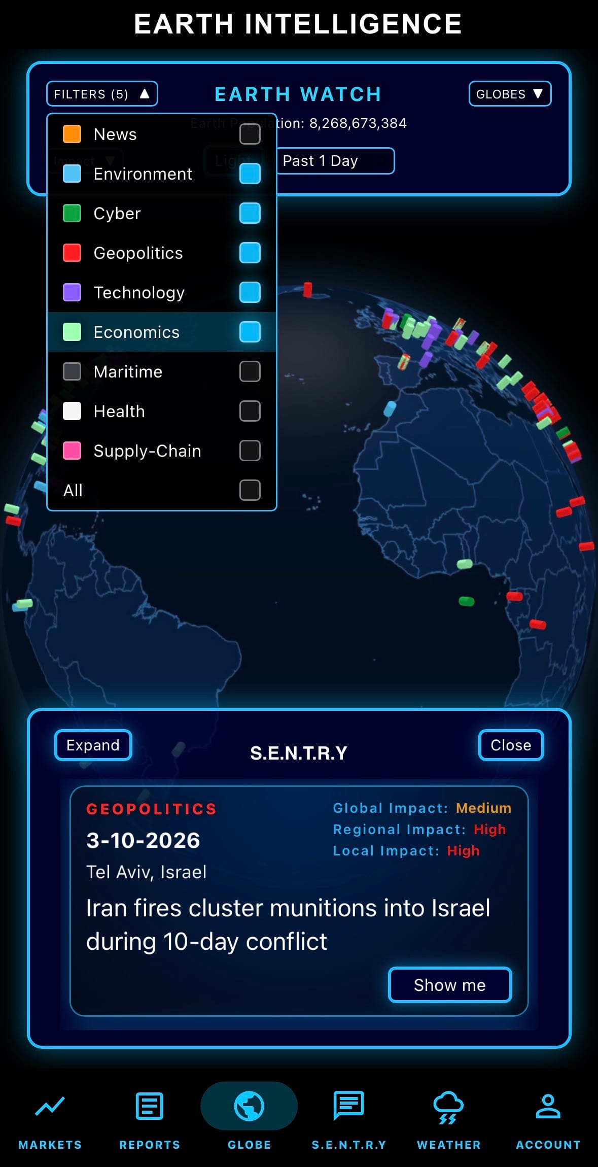
- Click below if you’d like to view our free EARTH WATCH globe:
- Download our mobile app:

Click below to view our previous newsletters:
Support/Suggestions Email:
support@earthintel.io