Wednesday☕️


Economics & Markets:
- Yesterday’s U.S. stock market:

- Yesterday’s commodity market:

- Yesterday’s crypto market:

Geopolitics & Military Activity:
- On August 13, residents in Unecha, located in Russia's Bryansk Region, reported a drone attack targeting the Unecha Linear Production and Dispatch Station in Vysokoye village, Unechsky District. Unverified videos shared on social media showed a distant glow at the site, suggesting a possible fire or explosion. The regional governor announced that Russian air defense forces had destroyed 12 aircraft-type unmanned aerial vehicles over the Bryansk Region, with no immediate reports of casualties or confirmed damage, though operational and emergency services were deployed to assess the situation and respond accordingly.
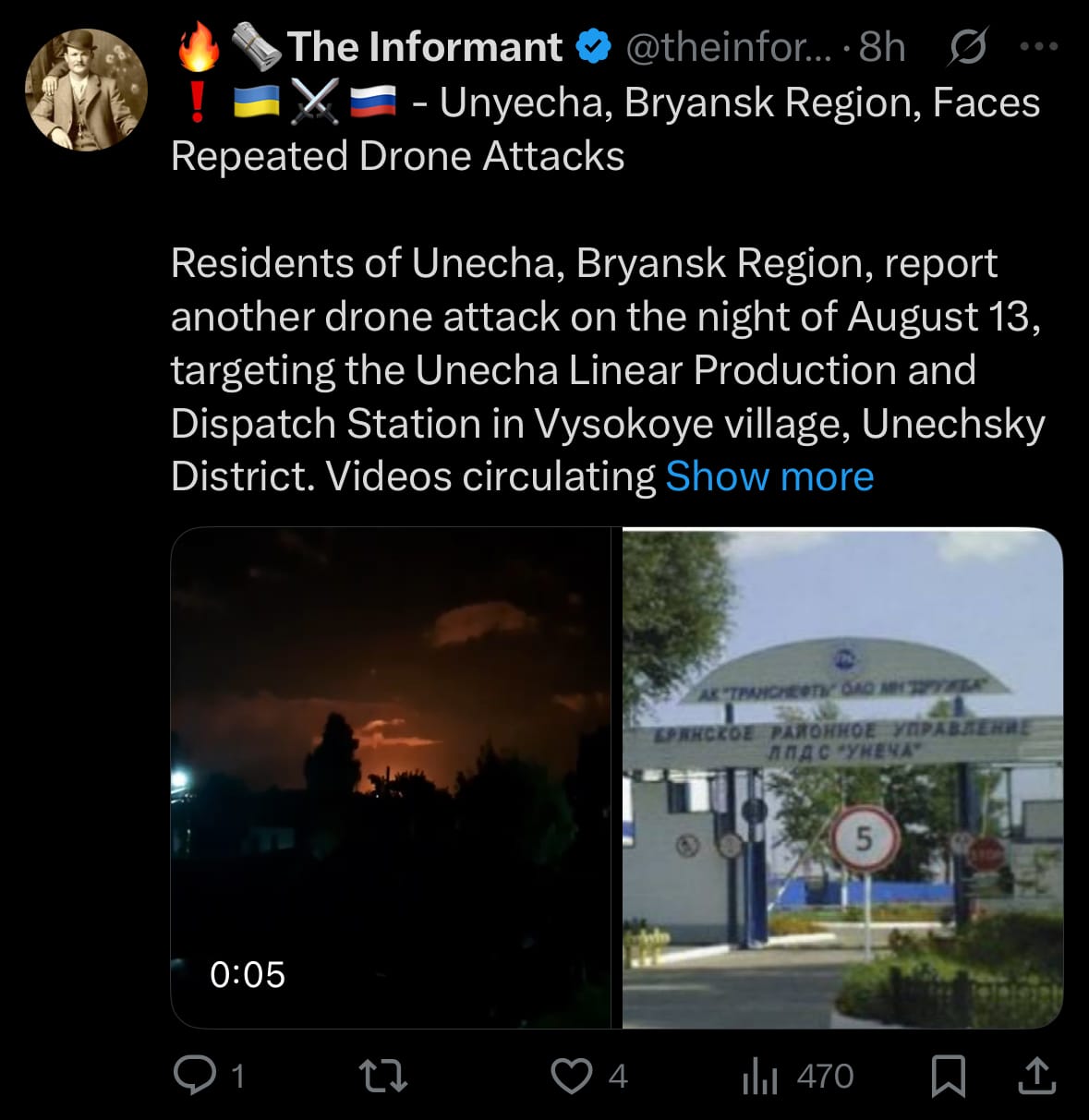
- This event follows a similar incident on August 6, when at least one drone struck the same station, resulting in a fire. The Unecha facility serves as a key hub in the Druzhba oil pipeline network, operated by AK Transnefteprodukt, which focuses on oil transportation via pipelines. Spanning approximately 8,900 kilometers and crossing multiple countries as well as 45 major rivers, the Druzhba system plays a significant role in energy infrastructure, highlighting the strategic importance of such sites amid ongoing regional tensions.
Environment & Weather:
- On August 12, 2025, intense rainfall led to significant flash flooding in Chattanooga, Tennessee, and nearby parts of Hamilton County. The area received over six inches of rain in a short period, ranking as the second-wettest day on record since 1879, which prompted flash flood warnings that lasted into the evening. This resulted in submerged roadways, stranded vehicles on key routes such as Interstate 24, and the need for water rescues and evacuations, with local officials advising residents to remain indoors and avoid unnecessary travel.
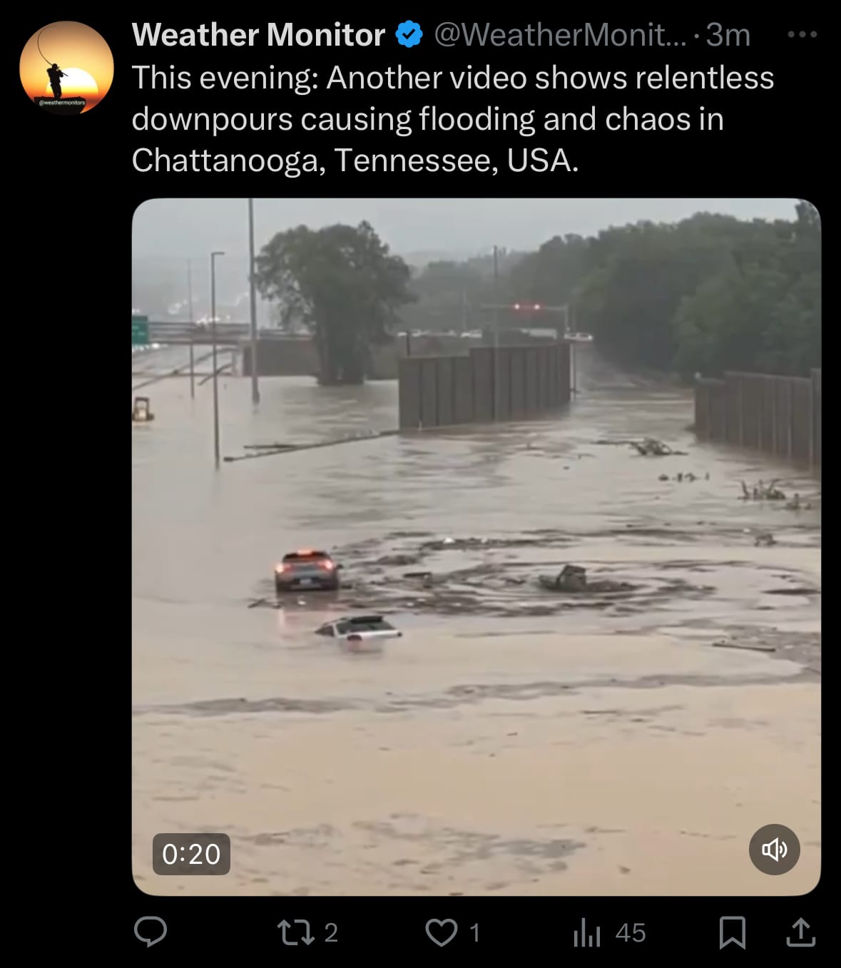
- Affected areas encompassed Amnicola Highway, Shallowford Road, East Brainerd, Hamilton Place, downtown Chattanooga, and Hixson, with portions of Interstate 24 temporarily closed between Belvoir Avenue and Spring Creek Road, as well as between I-75 and US-27, though some sections have since reopened. The Hamilton County Sheriff's Office and emergency services coordinated the response, including rescues from flooded homes, while the American Red Cross established a shelter at the Brainerd Public Recreation Center for those displaced. Hamilton County Schools closed on August 13 due to lingering road hazards, and a local state of emergency was declared to address the strain on infrastructure amid regional weather influences in the Tennessee Valley, with no injuries reported as of early August 13.
Space:
- On August 12, 2025, Arianespace successfully launched the Ariane 6 rocket from Europe's Spaceport in Kourou, French Guiana, at 9:37 p.m. local time. This mission, designated VA264, marked the second commercial flight for the Ariane 6 launcher and aimed to deploy the Metop-SGA1 satellite into a Sun-Synchronous Orbit at approximately 800 km altitude. The launch was confirmed successful, with signals acquired from the satellite shortly after deployment, supporting Europe's efforts in weather forecasting and climate monitoring.

- The payload, Metop-SGA1, is the first of a new generation of polar-orbiting weather satellites built by Airbus Defence and Space for the European Space Agency (ESA) and operated by EUMETSAT. It carries six instruments for atmospheric sounding and imaging, including optical, infrared, and microwave observations, as well as the Copernicus Sentinel-5 mission for air quality monitoring. The Ariane 62 configuration of the launch vehicle was used from the ELA-4 launch pad, highlighting Arianespace's role in providing autonomous European access to space for environmental and scientific missions.
Statistic:
- Largest public telecommunications companies by market capitalization:
- 🇺🇸 T-Mobile US: $283.92B
- 🇨🇳 China Mobile: $246.73B
- 🇺🇸 AT&T: $203.64B
- 🇺🇸 Verizon: $182.35B
- 🇩🇪 Deutsche Telekom: $173.55B
- 🇯🇵 SoftBank: $141.66B
- 🇮🇳 Bharti Airtel: $127.27B
- 🇺🇸 Comcast: $118.51B
- 🇺🇸 American Tower: $95.81B
- 🇯🇵 NTT (Nippon Telegraph & Telephone): $91.19B
- 🇨🇳 China Telecom: $90.47B
- 🇯🇵 KDDI: $68.13B
- 🇲🇽 America Movil: $57.60B
- 🇸🇦 Saudi Telecom Company: $56.24B
- 🇸🇬 Singtel: $51.97B
- 🇺🇸 Crown Castle: $44.56B
- 🇫🇷 Orange: $43.78B
- 🇦🇪 Emirates Telecom (Etisalat Group): $43.19B
- 🇭🇰 China Unicom: $40.65B
- 🇨🇭 Swisscom: $37.37B
- 🇦🇺 Telstra: $37.05B
- 🇺🇸 Charter Communications: $35.93B
- 🇹🇼 Chunghwa Telecom: $35.15B
- 🇪🇸 Telefónica: $30.89B
- 🇬🇧 Vodafone: $27.91B
History:
- The history of wildfire detection, management, and response technology began in the early 20th century, largely in response to catastrophic events like the Great Fire of 1910 in the United States, which prompted the establishment of fire lookout towers staffed by human "fire spotters" who used heliographs for communication from high vantage points. These manual systems dominated until the late 20th century, when they were gradually retired as more automated methods emerged. By the mid-20th century, satellite technology marked a significant milestone, with early applications in the 1980s utilizing sensors like the Advanced Very High Resolution Radiometer (AVHRR) to detect fires through infrared brightness temperature comparisons, though limited by low spatial resolution and environmental interferences such as clouds. Ground-based approaches also evolved, including initial wireless sensor networks in the 2000s that monitored environmental factors like temperature and humidity to aid early detection.
- Advancements accelerated in the 21st century, shifting from reactive, labor-intensive methods to proactive, data-driven systems integrating artificial intelligence, drones, and multi-platform monitoring. Key milestones include the 1999 CubeSat initiative for affordable satellite deployments, the 2014 launch of camera networks like ALERTWildfire for AI-assisted smoke detection, and the rise of unmanned aerial vehicles (UAVs) equipped with thermal sensors for real-time surveillance and even prescribed burns. Today's advanced systems encompass satellite imaging (e.g., MODIS and VIIRS for large-scale heat detection), IoT-enabled sensor networks for continuous environmental monitoring, AI and machine learning for predictive modeling and resource allocation, LiDAR and GIS for vegetation management to reduce fuel loads, firefighting robots for hazardous terrain navigation, and autonomous aerial systems for suppressant delivery during night operations. These technologies enable faster response times, minimizing risks to firefighters and enhancing overall wildfire containment.
Image of the day:

Thanks for reading!
Earth is complicated, we make it simple.
Click image to view the Earth Intelligence System:


Support/Suggestions Email:
earthintelligence@earthintel.news