Friday☕️


Economics & Markets:
- Yesterday’s U.S. stock market:

- Yesterday’s commodity market:

- Yesterday’s crypto market:

Geopolitics & Military Activity:
- On November 6, 2025, Ukrainian forces conducted drone strikes on the Lukoil oil refinery in Volgograd, Russia, causing a significant fire and operational disruptions at the facility. The attack, part of ongoing Ukrainian efforts to target Russian energy infrastructure, led to the refinery's temporary shutdown as emergency crews worked to extinguish flames and assess damage. Local authorities reported active air defenses intercepting multiple drones, with debris causing additional fires at a substation in nearby Frolovo, though no immediate casualties were confirmed at the refinery site. The incident prompted heightened security measures in the region, with airports in Volgograd and Saratov temporarily halting operations due to the drone threat.
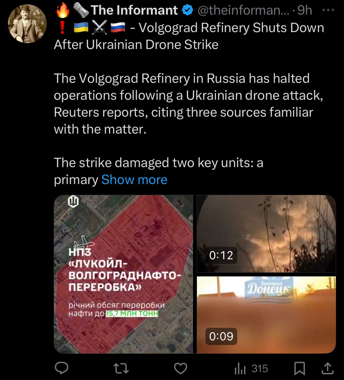
- This strike reflects Ukraine's strategy to impair Russia's economic and military capabilities amid the prolonged conflict, focusing on oil refineries that contribute to fuel supplies for Russian forces. While it may disrupt Russian oil production and exports, potentially affecting global energy markets, it also escalates tensions, drawing criticism from Moscow as an act of terrorism and prompting vows of retaliation.
Israeli Airstrikes In Lebanon:
- On November 6, 2025, the Israel Defense Forces (IDF) carried out a series of airstrikes in southern Lebanon, targeting Hezbollah positions in villages including Tayr Debba, Khiam, and Ayta ash-Shab, following evacuation warnings issued to residents. The strikes, described by the IDF as preemptive measures to prevent Hezbollah from rearming and rebuilding infrastructure near the border, resulted in visible smoke and destruction but no immediate reports of casualties.
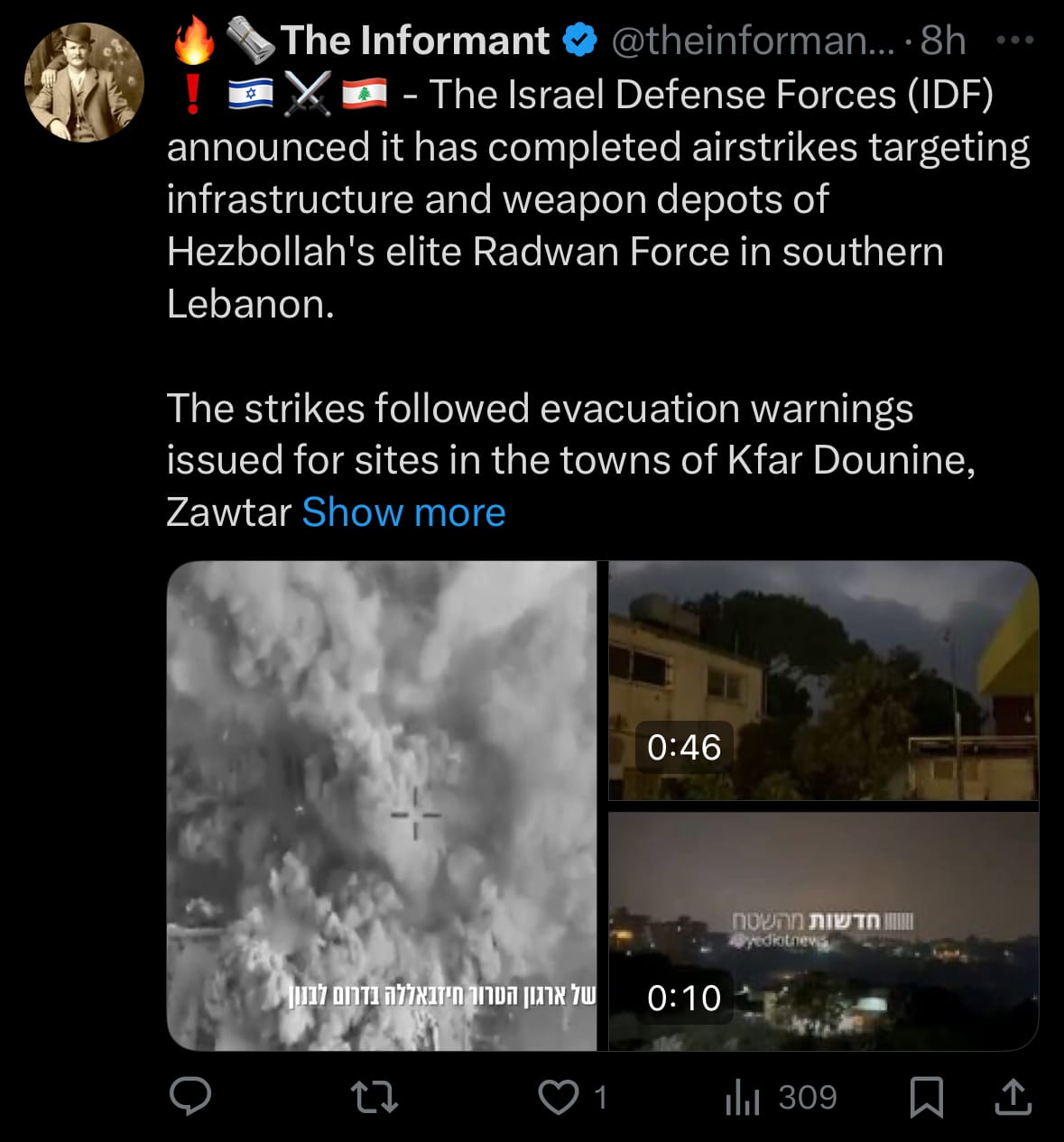
- The operations reflect ongoing tensions in the region, where Israel aims to enforce UN resolutions requiring Hezbollah's disarmament south of the Litani River, while Lebanon accuses Israel of sabotaging peace efforts. Involved parties include the IDF, Hezbollah (backed by Iran), and international observers like the United Nations Interim Force in Lebanon (UNIFIL), which has called for restraint to avoid escalation.
Environment & Weather:
- On November 6, 2025, the death toll from Typhoon Tino, internationally known as Kalmaegi, surpassed 115 in the Philippines, with at least 127 people reported missing, primarily in the central regions of Cebu and Leyte where the storm made landfall two days prior. Heavy rains, floods, and landslides devastated communities, destroying homes, submerging vehicles, and causing widespread power outages affecting over 500,000 households. Emergency aid is being distributed to displaced residents in shelters, while assessments reveal significant infrastructure damage, including blocked roads and disrupted water supplies, prompting a state of calamity declaration in several provinces.
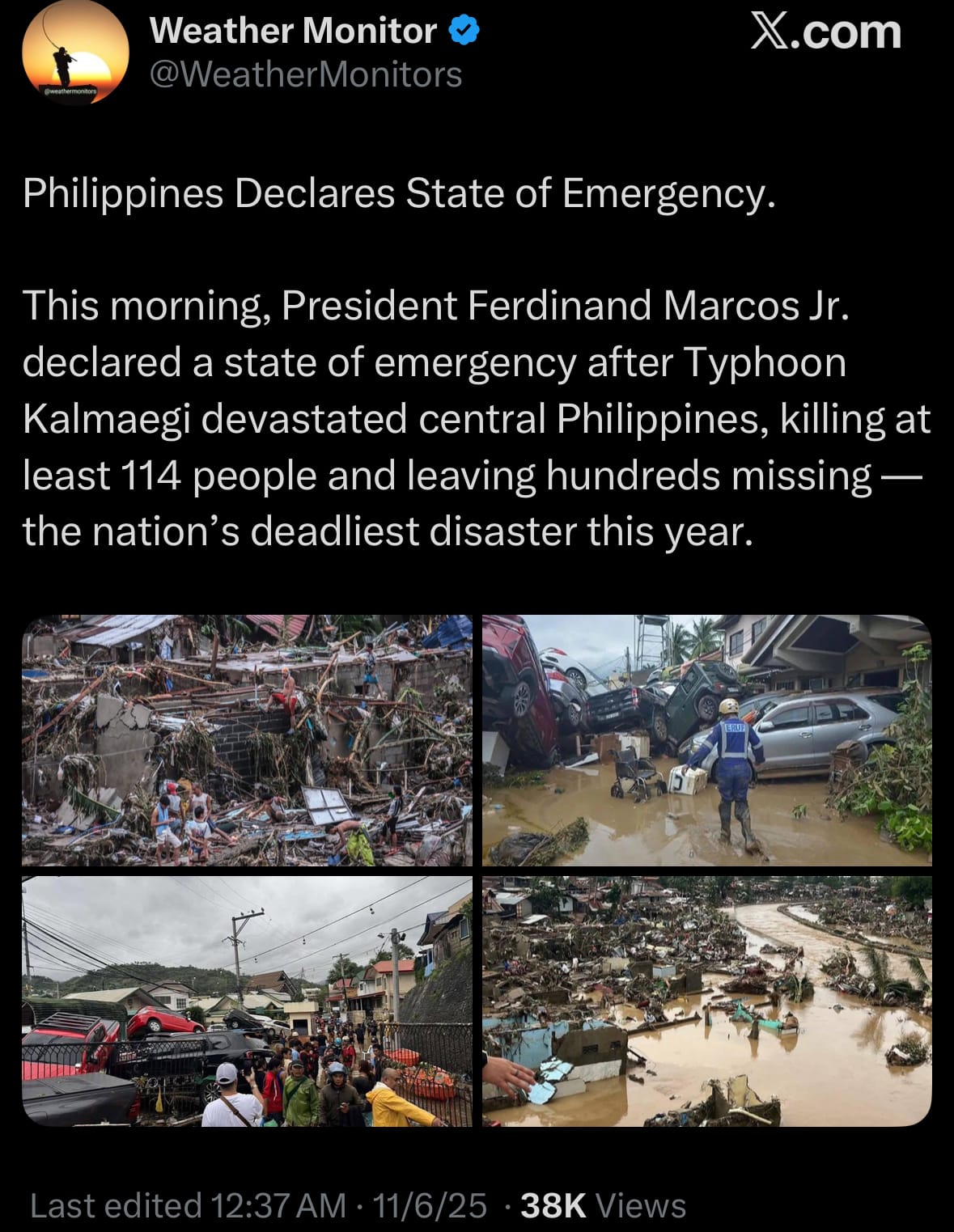
- The typhoon's intensity, fueled by warm ocean waters during the ongoing solar maximum phase, led to rainfall exceeding 300 mm in some areas, exacerbating vulnerabilities in flood-prone zones. As the storm weakens and moves toward Vietnam, focus shifts to recovery in the Philippines, with international aid from organizations like the Red Cross providing essentials.
Space:
- On November 6, 2025, SpaceX successfully launched a Falcon 9 rocket from Space Launch Complex 4 East (SLC-4E) at Vandenberg Space Force Base in California, deploying 28 Starlink satellites into low-Earth orbit as part of the Starlink 11-14 mission. The launch occurred at 1:13 p.m. PST (4:13 p.m. EST), with the first-stage booster landing on the droneship Of Course I Still Love You stationed in the Pacific Ocean, showcasing the company's reusable rocket technology.
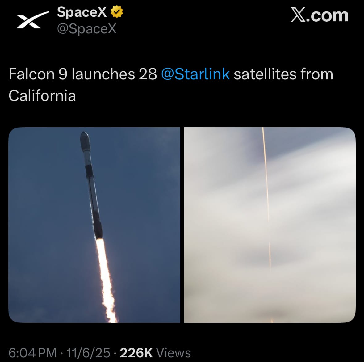
- The launch represents another step in SpaceX's high-cadence operations, with multiple Starlink missions occurring weekly to meet growing demand for broadband services. As SpaceX continues to scale its network, these deployments will heavily influence competition in the telecom sector, forcing traditional telecom companies to convert to satellites over traditional cell towers.
Statistic:
- Largest public airport companies by market capitalization:
- 🇪🇸 Aena: $38.88B
- 🇹🇭 Airports of Thailand: $18.21B
- 🇫🇷 Aéroports de Paris: $13.59B
- 🇮🇳 GMR Airports: $11.29B
- 🇨🇳 Shanghai Airport (AVINEX): $11.25B
- 🇲🇽 Grupo Aeroportuario del Pacífico: $10.68B
- 🇲🇽 Grupo Aeroportuario del Sureste: $9.25B
- 🇨🇭 Zurich Airport: $9.05B
- 🇩🇰 Copenhagen Airport: $8.30B
- 🇳🇿 Auckland Airport: $7.78B
History:
- Satellite-based intelligence began in the crucible of the Cold War, when the United States and the Soviet Union raced to peer into one another’s secrets from orbit. Early efforts like the U.S. CORONA program in the 1960s used film-return capsules—literal canisters dropped from space and caught midair—to capture photographic reconnaissance of enemy missile sites and installations. As imaging technology improved, optical systems shifted from film to digital sensors, enabling near-real-time intelligence rather than weeks-long delays. Military imaging satellites became the eyes of national security, providing unprecedented detail of troop movements, nuclear facilities, and infrastructure. By the 1980s, satellites could distinguish objects only a few inches wide, fundamentally changing the intelligence landscape—no longer was espionage limited to spies on the ground; entire nations could now be surveilled from above.
- The evolution expanded beyond visible light. Synthetic Aperture Radar (SAR) satellites introduced the ability to “see” through clouds, darkness, and camouflage by measuring reflected radio waves rather than visible light. Infrared sensors added the capability to detect heat signatures from vehicles, missile launches, and even underground activity. These advancements merged into a complex web of multispectral and hyperspectral imaging systems, capable of analyzing chemical compositions and environmental changes. Modern military and intelligence agencies now integrate optical, radar, and thermal satellite data to form a continuous, multidimensional view of Earth—tracking conflict zones, verifying treaty compliance, and mapping disaster areas with scientific precision. What began as grainy black-and-white photos of enemy territory has evolved into an omnipresent digital surveillance architecture, shaping geopolitics, warfare, and the very concept of global transparency.
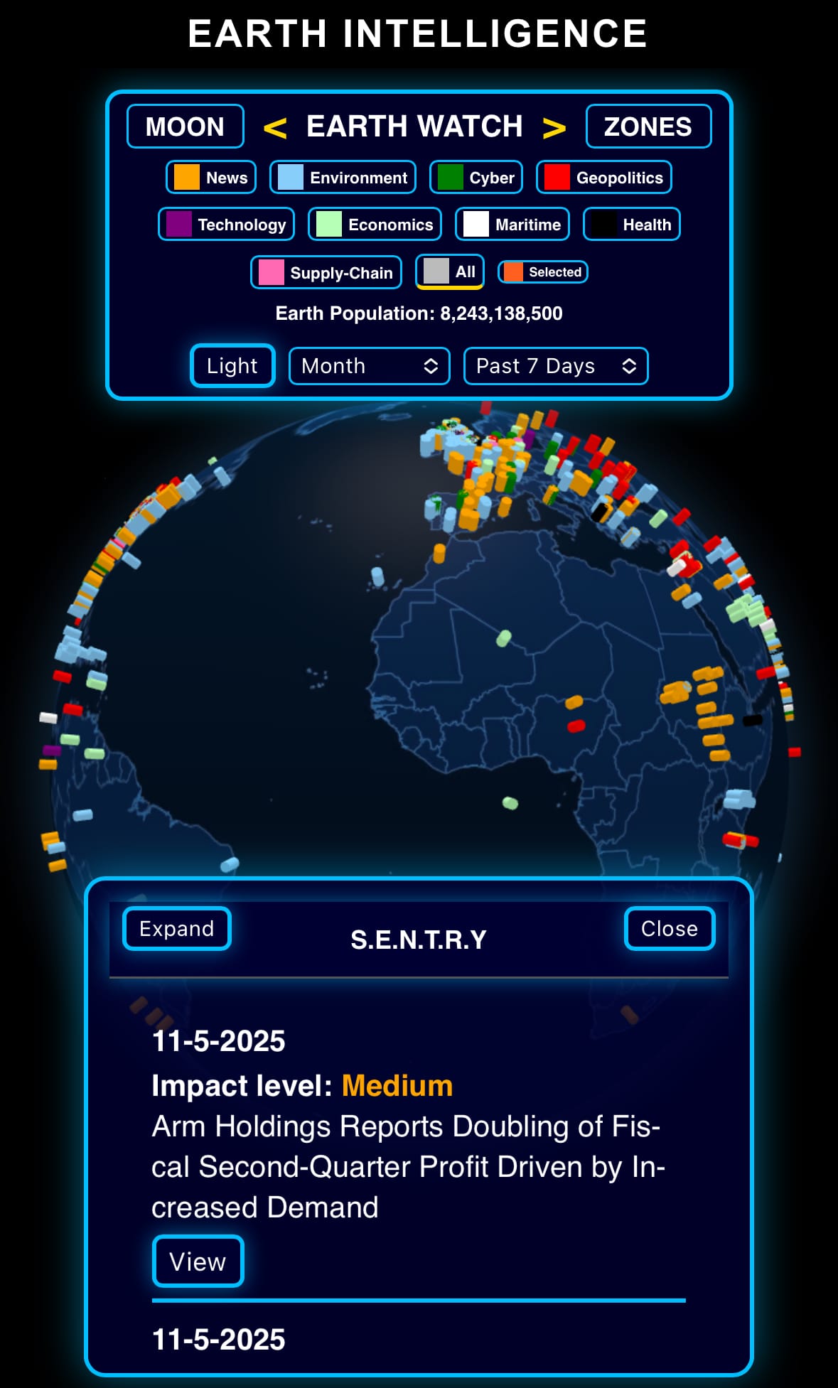
Image of the day:

Thanks for reading!
- EARTH INTELLIGENCE builds private intelligence systems for organizations — connecting their internal and external data with AI to create one interactive command center for real-time awareness, decision making, and predictions.
Earth is complicated, we make it simple.
- Click below if you’d like to view our free EARTH WATCH globe:

Click below to view our previous newsletters:

Support/Suggestions Email:
earthintelligence@earthintel.news